Troschenreuth (Vogtland)
|
Troschenreuth
Triebel / Vogtl municipality .
Coordinates: 50 ° 20 ′ 59 ″ N , 12 ° 0 ′ 31 ″ E
|
|
|---|---|
| Height : | 510 m |
| Incorporation : | July 1, 1950 |
| Incorporated into: | Wiedersberg |
|
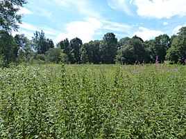
Former town center overgrown by nettles
|
|
Troschenreuth was a place near Wiedersberg in the Saxon Vogtland and was completely destroyed in 1972 by the border troops of the GDR . Field Marshal Heinrich von Holk , leader of the infamous Holk Horsemen, died in the village during the Thirty Years' War .
geography
The place was 2 km southeast of Wiedersberg in the Feilebachtal , near the Oberhartmannsreuth district of the community of Gattendorf in the Bavarian Vogtland. The Klippe inn bordered directly on Bavaria. The district of Ebersberg , which was also destroyed, belonged to Troschenreuth .
history
The exact history of the origins of Troschenreuth (clearing of a Troitzsch) is not entirely clear, but the early history is closely linked to that of Wiedersberg and Wiedersberg Castle . The place probably served as a Vorwerk as early as the 12th century . A mansion was also built at that time. Initially the owners were the von Wiedersperg family . It was followed by the von Sack and, up to the 16th century, the von Magwitz . The Danish field marshal Heinrich von Holk died of the plague in the manor house on September 9, 1633 . At that time he was in the imperial service under Wallenstein and with his horde also wreaked havoc in the Vogtland. His body was not buried in Troschenreuth, but taken by his troops to Adorf and brought from there to Denmark in a tin coffin.
Ecclesiastically Troschenreuth belonged to the controversial parish of Wiedersberg and was thus partly obliged to Bavaria. In terms of ownership, however, the place no longer belonged to Wiedersberg from 1802. It had its own jurisdiction before, as the name Galgenberg indicates immediately to the north of it. The place belonged to the Voigtsberg office until the 19th century .
After the Second World War , the manor owners were expropriated and the place was incorporated into Wiedersberg on July 1, 1950. Immediately afterwards, due to the proximity to the inner-German border, the measures of the GDR State Security against the residents began, which began with individual forced evacuations ( Action Verziefer ) and ended in 1972 with the complete demolition of the place.
present
There are no more houses in Troschenreuth. Only individual groups of trees give an idea of the former locations. The area is now part of the Feilebach nature reserve as part of the German Green Belt nature conservation project . From a hydrological point of view, the name of the place is still present in the Troschenreuth foothills, a dam of the Oberhartmannsreuther Bach in the catchment area of the Dröda drinking water reservoir . The districts of Troschenreuth and Ebersberg still exist today.
Structurally visible, only the somewhat remote hereditary burial is reminiscent of the former settlement. It is in poor condition because it was desecrated during the GDR era.
literature
- Album of the manors and castles in the kingdom of Saxony . 1859 in the archive of the Saxon State Library - Dresden State and University Library (SLUB) ( online )
- Wolfgang Seffner: The manors of the Vogtland, their fate in the 20th century . Vogtland-Verlag, Plauen 2002, ISBN 3-928828-21-5 , pp. 129f.
Web links
- Location and map on a map from 1877
Individual evidence
- ^ Troschenreuth in the Digital Historical Directory of Saxony


