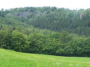
Hillside stone
| Hillside stone | ||
|---|---|---|
|
View from the east of the hillside stone |
||
| height | 483.3 m above sea level HN | |
| location | Ruhla in Thuringia ( Germany ) | |
| Mountains | Thuringian Forest | |
| Coordinates | 50 ° 55 '16 " N , 10 ° 20' 2" E | |
|
|
||
| rock | Rotliegend | |
| particularities | The Mosbach Hell - a gorge | |
Today, the Hangstein is an almost completely wooded mountain on the Rennsteig in the Wartburg district . Its height is 483.3 m above sea level. HN , it is thus the highest point in the municipality of Wutha-Farnroda . The mountain consists of Rotliegend (the rock is also known as the Wartburg conglomerate in West Thuringia).
The corridors of the districts of Mosbach (Wutha-Farnroda) and Ruhla meet near the summit . The remainder of a high pasture, the "Fuchswiese" is the most south-westerly point of Wutha-Farnroda. The nearby “Ochsenstall” in the “Mosbacher Hölle”, a gorge popular with hikers, is located on the northern slope of the hillside stone. According to local tradition, it is considered a safe hiding place for the cattle of the Mosbach farmers during the Thirty Years 'War and the Seven Years' War . Since there was always enough water and food in the tiny valley, the animals didn't give themselves away by loud roaring.
Another legend reports "Of the beautiful strangers":
- At the time of the fair, two beautiful virgins appear on the hillside stone, who bewitch the Mosbach youths with their charm. Intoxicated by the dance, beer or wine, the bravest lads followed the two to a rendezvous at a spring under the hillside stone. Usually those fellows were found lying at the foot of the rocks the following morning with their bodies shattered.
On the slope of the mountain there are some well over 10 m high rock areas that climbers visit for training. A relatively short and moderately steep hiking trail runs over the hillside from Mosbach to the Rennsteig.
Individual evidence
- ↑ Thuringian Land Survey Office TK25 - sheet 5028 Eisenach Ost , Erfurt 1998, ISBN 3-86140-048-0
- ↑ A small explanatory board for the field name Ochsenstall is located at the entry point into the gorge.
- ↑ Manfred Thiele et al: From treasures, Venetians and ghosts. Legends from the area of Ruhla, Seebach, Thal and Winterstein . Ruhla 1985, The Beautiful Unknowns, p. 34 .
- ↑ Official topographic maps of Thuringia 1: 10,000. Wartburgkreis, district of Gotha, district-free city of Eisenach . In: Thuringian Land Survey Office (Hrsg.): CD-ROM series Top10 . CD 2. Erfurt 1999.


