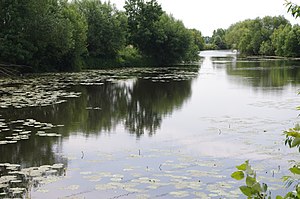
Hilgermisser Kolk
| Hilgermisser Kolk | ||
|---|---|---|

|
||
| Geographical location | Hilgermissen municipality , Nienburg / Weser district , Lower Saxony , Germany | |
| Tributaries | Hoyaer Emte | |
| Drain | Hoyaer Emte | |
| Data | ||
| Coordinates | 52 ° 50 '27 " N , 9 ° 9' 40" E | |
|
|
||
| Altitude above sea level | 14.5 m | |
| surface | 1.56 ha | |
| length | 420 m | |
| width | 40 m | |
| Maximum depth | 1.8 m | |
| Middle deep | 1.4 m | |
The Hilgermisser Kolk is a still water in the municipality Hilgermissen in the joint municipality Grafschaft Hoya in the district of Nienburg / Weser in Lower Saxony .
The lake, which is about 420 meters long, 40 meters wide, a maximum of 1.80 meters deep and has an area of 1.56 hectares , is located east of the core town of Hilgermissen and is from south to north by the Hoyaer Emte , a tributary of the Weser , crossed. Other tributaries of the lake are the Ahegraben in the northeast and the Mehringer Graben on the southern edge.
