Hinnensee
| Hinnensee | ||
|---|---|---|

|
||
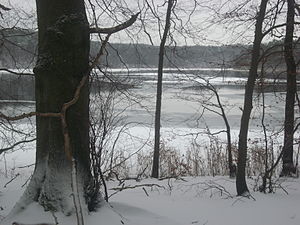
| Winter shot at the Hinnensee | ||
| Geographical location | District of Mecklenburg Lake District | |
| Tributaries | from Güsterpohl | |
| Drain | Transition to the Großer Fürstenseer See | |
| Places on the shore | none | |
| Data | ||
| Coordinates | 53 ° 19 '27 " N , 13 ° 11' 17" E | |
|
|
||
| Altitude above sea level | 63.8 m above sea level NHN | |
| surface | 48 ha | |
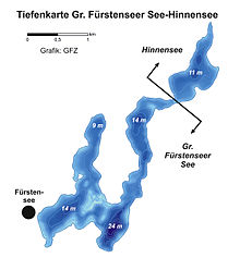
| Maximum depth | 13.8 m | |
The Hinnensee is located in the Mecklenburg Lake District in southeast Mecklenburg in the municipal area of Wokuhl-Dabelow . In the south-west, on the approximately 50-meter-narrow and two-meter-deep narrow lake to the Großer Fürstenseer See , it borders on the urban area of Neustrelitz . It has an approximate length of 1500 meters and an approximate width of 500 meters. The lakeshore is completely wooded and very hilly. On the steep northeastern shore of the lake, the heights reach over 100 meters above sea level. NHN.
Underwater vegetation
The nutrient content of the water and the concentration of the plankton are decisive for the clarity of the lake and thus also the range of species of its underwater plants. Of particular importance is the large-scale occurrence of is stoneworts (Characeae) in the lake. These algae are mainly found in lime-rich, nutrient-poor waters. While there are up to 20 species in the Großer Fürstenseer See (lower macrophyte limit at 9 m), only five species can be found in the Hinnensee (lower macrophyte limit at 6 meters).

