Hirschbühel
| Hirschbühel | ||
|---|---|---|
|
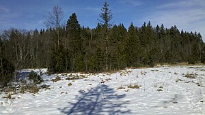
In the Babenstuben moor with the wooded Hirschbühel in the background |
||
| height | 641 m | |
| location | Bad Tölz-Wolfratshausen district , Bavaria , Germany | |
| Mountains | Alpine foothills | |
| Dominance | 0.73 km → at the hamlet of Haag | |
| Notch height | 27 m | |
| Coordinates | 47 ° 51 '9 " N , 11 ° 26' 49" E | |
|
|
||
The Hirschbühel ( 641 m ) is a hill near Geretsried .
topography
The Hirschbühel is located on the edge of the Babenstubener Moore nature reserve (NSG-00325.01), roughly halfway between the hamlets of Babenstuben and Schwaigwall.
The highest point of the Bühel is wooded and can only be reached without a path.
literature
- Bavarian Land Surveying Office: Topographic map 1: 50000

