Historic old town Meiningen
The historic old town of Meiningen is the 25 hectare city center that was created in the Middle Ages within the former city fortifications. As a monument ensemble, it is part of the urban development protection program , which has been running since 1991 and which, under the project name “Meiningen Old Town”, covers almost the entire city center with a total of 94 hectares. In 2015, Meiningen's old town had 3412 inhabitants.
location
The historic town is located at an altitude of 287 m above sea level and takes the southern part of the in the geographical center of the city of Meiningen district center or the inner city. The city center is now surrounded by the northern inner city around the Englischer Garten , the inner city area along Neu-Ulmer-Strasse in the east, the western inner city area Auf dem Mittleren Rasen and the Südstadt district (Georgenvorstadt). The two medieval moats with ramparts and the “Mühlgraben”, known as “Bleichgräben”, represent a clear demarcation from these parts of the city. Until 1974, federal road 19 ran north-south through the middle of the old town.
description
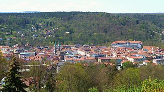
The historic old town consists of the actual old town and the area around Elisabethenburg Castle (until 1682: Meiningen Castle ), which from the Middle Ages to around 1820 was made up of a city fortification with a double city wall, a triple moat system in front of it in the north, east, south and mill moat and Werra in the west were completely fenced. The outline of the old town is clearly recognizable from the moats and mill moats that have been preserved to this day. The city center is divided into four districts , which are grouped around the central market square. The boundaries are formed by the streets Georgstraße and Anton-Ulrich-Straße running from north to south and the streets Fischergasse, Schlundgasse and Untere Kaplaneistraße, which run from west to east. In the GDR era, the neighborhoods were called residential districts 3, 4, 17 and 18.
The 1st quarter occupies the southwest of the old town. Buildings worth seeing are some half-timbered houses, the Schlundhaus and the Catholic Church . This quarter suffered particularly from decay during the GDR era, which ultimately led to numerous building demolitions, especially on the outer peripheral areas. Today there are three to five-storey prefabricated buildings here , the architectural style being adapted to the old town.
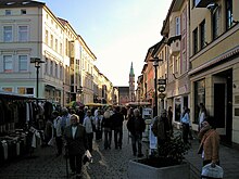
In the second quarter to the north-west are the Elisabethenburg Palace and the Theater Museum . Structurally the district is dominated varied, in addition to the ducal buildings there are specialists and town houses, several art nouveau buildings , some modern buildings and classical blocks as square . A special architectural monument is one of the few buildings on the main shopping street “Georgstraße” that was spared from the city fire → the half-timbered house in Büchnersches Hinterhaus .
The third quarter in the northeast forms the largest quarter of the old town . It was almost completely rebuilt after the great city fire of 1874. The quarter consists of blocks of houses laid out in a square, which are traversed by straight streets and whose block perimeter development consistently consists of massive three- to four-storey buildings built in a classical, eclectic style. The market square , the post office , the Meiningen state parliament building and individual town villas are important. Some modern buildings have also been built here.
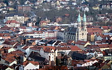
The fourth quarter is considered to be the nucleus of the city and is usually referred to as the “Old Town Quarter of the Pot”. It is characterized by narrow streets and small squares, the grid of which has hardly changed over the centuries. Here there are mainly two to three-story plastered and unplastered town houses and half-timbered houses. The vacant spaces created by the partial demolition are a particular focus of the urban redevelopment program in the east . The buildings here are the town church on the southern edge of the market, the "Fronveste", the stone house and the "Hartung'sche house".
history
→ See main article: History of the city of Meiningen , sections up to: “Meiningen as capital and residence city”.
The historic old town was created around 1000, when the market square was laid out and construction of today's city church began. First the area around the pot market was built on, before the rest of the residential quarters were laid out with a regular street grid by the end of the 13th century and finally the entire city was first fenced with moats and, from the 13th century, with city walls. In the north and south, the two main gates stood as gate towers , which were later placed in front of ravelines . In the 15th century, several city fires destroyed almost the entire city. From 1500 to the beginning of the 17th century, the population grew from around 2200 to around 4800 citizens. During the Thirty Years War, the city lost 70% of its population through death and displacement and 40% of its development through decay and destruction. Since 1692 the newly built Elisabethenburg Castle has had a decisive influence on the cityscape. At the time of the enlightened absolutism around 1800 the city wall, gate towers and the outermost moat were removed, with the exception of a few remains, and the first suburban streets were built.
In 1874, the great fire of the city reduced around a third of the city center to rubble and ashes. The reconstruction took place with town houses and public buildings in the style of eclecticism ( historicism ). From then on, the city grew far beyond its medieval borders and the previous city became the old town. During the Second World War, an air raid destroyed the west side of the market with the town hall and city savings bank as well as large parts of the south-eastern old town. During the GDR era, the west and south of the old town in particular were left to decay, which in the 1980s was accompanied by large-scale demolitions in the western part and in the Töpfemarkt area. In the western section, a number of three- to five-storey prefabricated buildings were built between 1989 and 1991. Since 1991, with the help of funding restructuring and development measures and Urban Heritage protection since 2002 with the support program Urban Redevelopment East redeveloped the historic center.
See also
literature
- Kuratorium Meiningen (Hrsg.): Lexicon for the history of the city of Meiningen. Bielsteinverlag, Meiningen 2008, ISBN 978-3-9809504-4-2 .
- Peter Schmidt-Raßmann: Meiningen - as it used to be. Wartberg-Verlag, Gudensberg-Gleichen 1992, ISBN 3-925277-82-X .
Web links
- www.staedtebaufoerderung.info Stadtumbau Ost (pdf).
- www.staedtebaufoerderung.info Meiningen old town, practice.
Individual evidence
- ↑ Area measurement with Geoportal.de of the Federal Agency for Cartography and Geodesy
- ^ Federal Ministry for Transport, Building and Urban Development
- ^ Residents' registration office of the city of Meiningen
- ↑ Measured with Google Earth
- ^ Lexicon on the history of the city of Meiningen, pages 19/20.
Coordinates: 50 ° 34 ' N , 10 ° 25' E


