Door to
| Door to | ||
|---|---|---|
|
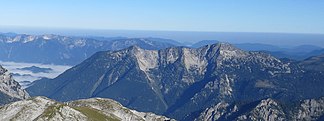
Türnachstock seen from the Hochschwab |
||
| Highest peak | Hochtürnach ( 1770 m above sea level ) | |
| location | Styria , Austria | |
| part of | Ybbstal Alps ( AVE ), Lassingalpen / Lower Austrian Limestone Alps (Trimmel) | |
| Classification according to | Trimmel 1816 | |
|
|
||
| Coordinates | 47 ° 39 '37 " N , 15 ° 7' 21" E | |
| Type | Limestone massif | |
| rock | Steinalm Formation ; Base throwing formation | |
| Age of the rock | 230–250 Ma ( Middle Triassic / Lower Triassic ) | |
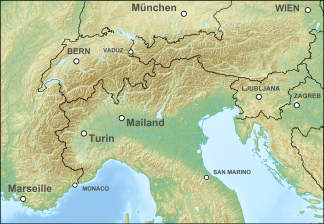
The Türnach is a small mountain range in the southernmost Ybbstal Alps ( Lassingalpen ), on the middle reaches of the Salza in Styria not far from Mariazell . The massif culminates in Hochtürnach at 1770 m above sea level. A.
Boundary and Neighboring Groups
According to the mountain group classification for the Austrian cave directory of Trimmel , where it has the number 1811, the massif is as follows:
- : in the northwest and north Bärenbach (Bärnbach) of the Salza (Bridge 632 m nbachsattels) to just south of the Bear [e] to about 1305 m - down to the rear Rotmoos to Kräuterin (Trimmel No. 1812th)
- in the east Radmerbach to the confluence (approx. 670 m ) in the Salza near Weichselboden to the Zellerhüten (No. 1813)
- in the south of Salza down to the Bärenbach to the Hochschwab (Trimmel No. 1744)
summit
On the elongated main ridge are from west to east:
- Bärnstein 995 m
- Guckkogel 1559 m
- Hochtürnach 1770 m
- Ameiskogel 1471 m
- towards the north, towards the Rotmoos, the ridge ends in the Bockmauer
To the south, the Prescenyriegel branches off to the Prescenyklause der Salza power plant , to the north the Brunnriegel .
geology
The stick consists of the Steinalm-Wetterstein limestone from the anise of the Middle Triassic around 240 million years ago, which also continues over the Salza to the southwest into the Riegerin . The basis is formed by Werfen strata , slate and limestone from the Lower Triassic , these form the basement of the northern Limestone Alps, to the south adjoining the Grauwackenzone , which is known to the southwest in the Eisenerzer Erzberg .

