Hohenwalde (desert)

Hohenwalde was a place south of Oberfrauenwald village , which in the 15th century desolate has fallen.
geography
The desert is located south of Oberfrauendorf in the high forest on the Faulen Pfütze at an altitude of 555.5 m above sea level. NHN . In the headwaters of the Prießnitz which flows into the Müglitz in Glashütte .
history
The first documentary mention was on May 14, 1404, when the village of Hohenwalde ( Hoenwalde ) next to the villages of Cunnersdorf ( Conradsdorff ), Oberfrauendorf ( Oberfrawendorff ) and Schlottwitz ( Slatewiez ) from Margrave Wilhelm von Meißen the Tyczemann von Grunenrode and Renczen von Grimme (Reinhardtsgrimma ) was loaned.
Already in 1492 the place was designated as wustung an dem Hoenwalde and in 1524 as wustung an dem Hohenwalde . In the 19th century the field name the high forest was used.
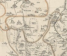
In the first survey of Saxony by Matthias Oeder , the name "Hohewald" appears. In 1733, Adam Friedrich Zürner gave the forest east of Schmiedeberg the name "Hohe Wald" in his map of the Meißnische Kreis .
Excavations at the beginning of the 21st century revealed that there was a castle that was probably shaped like a tower hill castle . According to the scientists, it may have been used to monitor mining there or to secure borders. With the help of laser images from the air, pinging was identified as a sign of mining, presumably iron ore was extracted.
literature
- Johann Friedrich Tolksdorf and others: Fortification, mining, and charcoal production: landscape history at the abandoned medieval settlement of Hohenwalde at the Faule Pfütze (Saxony, Eastern Ore Mountains) (Fortification, mining and charcoal production: landscape history of the abandoned medieval settlement Hohenwalde an der Faulen Puddle, Saxony, Eastern Ore Mountains), in E&G Quaternary Science Journal, 67, 2019, pp. 73–84
- Hohenwalde in the Historical Place Name Book of Saxony, Volume 1 - A to L, p. 434
Web links
- Hohenwalde (desert) in the Digital Historical Directory of Saxony
- Online report The legendary castle in the high forest in the Sächsische Zeitung.de from January 5, 2019
Individual evidence
- ↑ Openstreetmap.org , accessed December 19, 2019
- ↑ Representation in the digital historical directory of Saxony , accessed on December 19, 2019
- ↑ The first land survey of the Electorate of Saxony: carried out by Matthias Oeder (1586 - 1607) on the orders of Elector Christian I (1586 - 1607) for the 800th anniversary of the reign of the House of Wettin, published by the management of the Royal Central State Archives. Edited by Sophus Ruge. Facsimile edition of the hand drawing, scale 1:53 333. Stengel & Markert, Dresden 1889 ( link to the digitized version in the Dresden State and University Library )
- ^ Adam Friedrich Zürner: Description: ChurF. S. Land and Grentz Commiss. also Geographus, of the Electorate of Saxony Meisnischer Creis Geographice - Mscr.Dresd.J.20.d: delineiret and copied from the special charts prepared for every office and born together in this General Creis chart , hand drawing from 1733 ( Link to the map in the Saxon State and University Library )
- ↑ Online report The legendary castle in the high forest in the Sächsische Zeitung.de from January 5, 2019, accessed on December 19, 2019
Coordinates: 50 ° 50 ′ 15.6 " N , 13 ° 42 ′ 26.5" E
