
High fire
| High fire | ||
|---|---|---|
 High fire from OT Gopplasgrün, Erlbach |
||
| height | 802.8 m above sea level NHN | |
| location | Vogtlandkreis , Saxony ( Germany ) | |
| Mountains | Western Ore Mountains | |
| Coordinates | 50 ° 20 '26 " N , 12 ° 23' 26" E | |
|
||

The Hohe Brand is an 802.8 m above sea level. NHN high mountain in the Western Ore Mountains and is located in the Vogtlandkreis in Saxony .
Geographical location and natural space
The Hohe Brand rises about 5 km west-southwest of Klingenthal between the Czech border and the Zwota valley. It is completely forested. In terms of natural space , the mountain is no longer included in the Elster Mountains , but forms the Hoher Hahn mountain ridge , which is part of the Klingenthal ridge and belongs to the Western Ore Mountains .
History and tourism
A triangulation stone from the royal Saxon land surveying stands on the Hohe Brand . In snow, the 9 km long “Hohe Brand Loipe” leads over the mountain. This runs between the “Gopplasgrüner Höhe” car park on federal road 283 and the Erlbach district of the Landesgemeinde . A 5 km long trail is signposted for families.
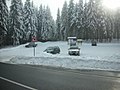
Parking lot at the Hohen Brand, access to the cross-country ski trail

9 km groomed trail

Triangulation column on the Hohe Brand

Road construction on the Hohen Brand in 2010

Radio tower on Pferdestallweg


Individual evidence
- ↑ a b Saxony Atlas of the Free State of Saxony ( notes )
- ↑ Natural areas and natural area potentials of the Free State of Saxony