
High damage
| High damage | ||
|---|---|---|
 The peak of the high damage |
||
| height | 388 m above sea level NN | |
| location | Eitorf , North Rhine-Westphalia | |
| Mountains | Leuscheid | |
| Coordinates | 50 ° 44 '17 " N , 7 ° 29' 56" E | |
|
||

At 388 m, the Hohe Schaden is the highest point in the municipality of Eitorf and in the Leuscheid forest area .
Two large stream systems arise from the high damage that do not leave the Leuscheid:
- The Wohmbach flows into the Eipbach at Obereiper Mühle .
- The Mühlenbach flows into the Sieg opposite Stromberg . The eponymous medieval mill east of Rodder went under for a long time.
In addition, the Dickersbach , the Sehlenbach and the Altebach arise from its Friedrichsquellen .
Side hills of the Hohe Schaden are Hurst with a height of 288 m and the Hüppelröttchen, named after a former forester's house . In the neighboring town of Stein there is a basalt quarry that testifies to former volcanic activity.
In 1867, a wooden observation tower was built on the summit, consisting of three floors, each ten feet high. Today the mountain no longer offers a panoramic view due to the trees on the summit.

High Damage Woods

Winter forest at Hohen Schaden
.jpg)


The Friedrichs Quellen framed in 1933
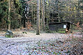
The Mooshütte southeast of the Hohe Schaden is the focus of many hiking trails


Individual evidence
- ^ Rhein-Sieg-Rundschau v. February 26, 2018, p. 35 Inga Sprünken: The decay of the Friedrichsquellen