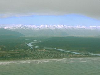
Hokitika River
| Hokitika River | ||
| Data | ||
| location | West Coast , South Island , New Zealand | |
| River system | Hokitika River | |
| source | Southern alps | |
| muzzle |
Tasman Sea Coordinates: 42 ° 43 ′ 18 " S , 170 ° 57 ′ 3" E 42 ° 43 ′ 18 " S , 170 ° 57 ′ 3" E
|
|
| length | 64 km | |
| Left tributaries | Whitcombe River | |
| Right tributaries | Kokatahi River | |
| Medium-sized cities | Hokitika | |
|
Upper course of the river |
||
The Hokitika River is a river in Westland District in the region West Coast on the South Island of New Zealand .
The approximately 64 km long river has its source in the Southern Alps and flows into the Tasman Sea near Hokitika . The Hokitika River, together with its tributary Kokatahi River, formed the Kowhitirangi - Kokatahi floodplain . This fertile area is used for dairy farming. The mouth of the river was used as a port during the gold rush on the west coast. However, shipwrecks often occurred because of the sandbank at the estuary. With the end of the gold rush, the port was no longer used.
South of Hokitika it is crossed by New Zealand State Highway 6 .
literature
- Richard Patrick Suggate: Hokitika River . In: Alexander Hare McLintock (Ed.): An Encyclopaedia of New Zealand . Wellington 1966 ( online [accessed December 15, 2015]).

