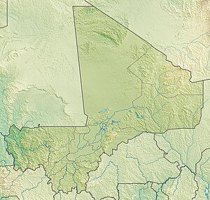
Hombori Tondo
| Hombori Tondo | ||
|---|---|---|
| height | 1153 m | |
| location | Mali , West Africa | |
| Mountains | Bandiagara rock massif / Hombori mountains | |
| Coordinates | 15 ° 15 '26 " N , 1 ° 40' 8" W | |
|
|
||
| Type | Table Mountain | |
The Hombori Tondo is the highest mountain in Mali at 1153 meters . The mesa is located in the immediate vicinity of the place Hombori on the road from Gao to Mopti and forms the northern end of Bandiagara rock massif .
Web links
Commons : Hombori Tondo - collection of images, videos and audio files

