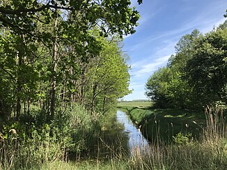
Horstgraben Horstwalde
| Horstgraben Horstwalde | ||
|
Horstgraben Horstwalde |
||
| Data | ||
| Water code | DE : 584452 | |
| location | Germany , Brandenburg | |
| River system | Elbe | |
| Drain over | Hammerfliess → Nuthe → Havel → Elbe → North Sea | |
| Headwaters |
Flemmingwiesen in the Baruther glacial valley 52 ° 3 ′ 56 ″ N , 13 ° 25 ′ 45 ″ E |
|
| muzzle | west of Horstwalde Coordinates: 52 ° 4 '44 " N , 13 ° 22' 53" E 52 ° 4 '44 " N , 13 ° 22' 53" E
|
|
| length | 5 km | |
| Catchment area | 33.578 km² | |
| Right tributaries | Dammwiesengraben, Dammwiesengraben Lynow | |
| Small towns | Lynow , Horstwalde | |
The Horst ditch Horstwalde is a Meliorationsgraben and a right tributary of the hammer little river in Brandenburg .
course
The ditch begins north of the residential development of Schöbendorf , a district of the city of Baruth / Mark . To the east the Paplitzer Müllergraben flows past in a south-north direction; however, there is no connection between the two trenches. After around 240 m in a westerly direction, it crosses under the path to Horstwalde south of the Bombachhaus, before the Dammwiesengraben flows into it after around another 500 m from the south. From there it flows around 2.5 km in a westerly direction between the Langen Horstberge in the north and the Langen Horstwiesen in the south. At the Horstmühlenweg the Dammgraben flows to Lynow from the south . The area east of the Horstmühlenweg is drained by the Biebergraben , which however has no connection to the Horstgraben Horstwalde, but drains directly into the Hammerfliess. From now on, the Horstgraben Horstwalde runs largely in a northerly direction, past the Horstmühle residential area before it finally drains south of Horstwalde into the Hammerfliess.
Individual evidence
- ↑ a b River directory gewnet25 (Version 4.0, April 24, 2014) at the Ministry for Rural Development, Environment and Agriculture of the State of Brandenburg, accessed on May 3, 2020.
