Horusický rybník
| Horusický rybník | ||
|---|---|---|

|
||
| Horusický rybník | ||
| Geographical location | Wittingau Basin , Czech Republic | |
| Places on the shore | Horusice | |
| Location close to the shore | Veselí nad Lužnicí | |
| Data | ||
| Coordinates | 49 ° 9 '23 " N , 14 ° 40' 33" E | |
|
|
||
| Altitude above sea level | 416 m nm | |
| surface | 4.15 km² | |
| volume | 3,970,000 m³ | |
| Maximum depth | 6 m | |
| Middle deep | 1.6 m | |
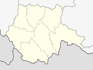
Horusický rybník (German Horusitzer pond ) is a pond in the Czech Republic . Measured in terms of the water area, it is the second largest pond in the country after the Rosenberg pond ; in terms of cadastral area it is also surpassed by the Bezdrev . It is located in the Wittingau basin , 3–5 kilometers southwest of the town of Veselí nad Lužnicí , and belongs to the okres Tábor . The E55 road and the 220 railway line from Prague to České Budějovice run on its north side .
Its dam is 730 meters long, 11 meters high and overgrown with old oaks. Road No. 24 leads across the dam from Veselí nad Lužnicí to Třeboň . In front of the dam is the deepest part of the pond at six meters; otherwise it is very flat with an average of 1.6 meters, which has a positive effect on fish farming. The water surface is at a height of 416 m nm and has an extension of 415 hectares; the cadastral area is 438 hectares, the volume 3.97 million m³. The catchment area is 61.5 km².
The pond was built in the years 1511–1512 according to the design of the Rosenberg pond builder Štěpánek Netolický on the Bukovský creek. It got its name from the village Horusice - today part of the town Veselí nad Lužnicí - which lies on its northern bank. Horusický rybník is the last pond on the Golden Canal , which connects the fish ponds of the Wittingau basin and supplies them with fresh water. About a kilometer further on, the canal flows into the Lainsitz .
Horusický rybník is one of the most productive fish ponds in the Czech Republic. In 2009 it produced 300 tons of fish, mainly carp . In addition, it is an ecologically valuable area. The pond serves as a breeding and resting place for water birds, in winter sea eagles can be observed here. The Ruda National Nature Reserve , a large spring moor, lies between the south-eastern bank of the pond and the Golden Canal . Iron was extracted from the bog in the 19th century and peat until the middle of the 20th century . Since 1950 it has been under nature protection because of its boreal relict vegetation, currently on 14.65 hectares (as of 2009). Since the end of peat extraction, it has been left to natural development, human interventions are limited to the removal of the succession . In the western part is the 54 hectare nature reserve Horusická blata , the remainder of a once also extensive spring moor, which was largely flooded when the pond was created.

