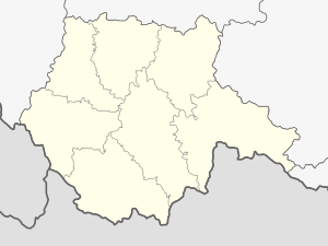
Rosenberg pond
| Rosenberg pond | ||
|---|---|---|

|
||
| Rosenberg pond and Káňov ponds | ||
| Geographical location | Třeboňská pánev between Třeboň and Lužnice ( Czech Republic ) | |
| Tributaries | Lainsitz , Zlatá stoka (Golden Canal) | |
| Drain | Lainsitz | |
| Data | ||
| Coordinates | 49 ° 2 '40 " N , 14 ° 46' 20" E | |
|
|
||
| surface | 4.89 km² | |
| volume | 6,200,000 m³ | |
|
particularities |
largest pond in the Czech Republic |
|
The Rosenberg Pond ( Rybník Rožmberk in Czech ) is a pond in the south of the Czech Republic . It is located in the Třeboňská pánev between Třeboň (Wittingau) and Lužnice (Luschnitz). The largest preserved pond in the Czech Republic is also called the South Bohemian Sea . The original size of 1,060 hectares has been reduced to the current 489 hectares.
The pond was built by Jakob Krčín von Jelčany, a dyke builder from Rosenberg, between 1585 and 1589. 800 workers were involved in the construction, 750,000 m³ of earth were moved. The dam is 2,430 meters long, up to 9.8 meters high and 51 meters wide at the base. The width of the dam crown, overgrown with oaks up to 400 years old, reaches 13.5 meters. The capacity is 6.2 million cubic meters. The Rosenbergweiher is fed by the river Lainsitz ( Lužnice in Czech ) and the Golden Canal . To protect the pond from flooding, Krčín built the Nová řeka canal above the pond , which guides the water from the Lainsitz into the Nežárka .
Pond management is still practiced in the Rosenberg pond. However, since the pond may not be fertilized in order not to impair the water quality of the Lainsitz, it is not very productive and is only fished every two years. A small hydroelectric power station with two Francis turbines and an output of 260 kW has stood under the dam since 1922 . The pond fulfills the most important function as a flood area in flood protection : Even the construction was probably a reaction to a great flood that reached Prague on August 20, 1544 from southern Bohemia. The protective function proved itself in the case of devastating floods in the years 1890 and 2002, among other things. During the floods in 2002 it held up to 75 million cubic meters of water and spread over an area of 2,300 hectares.
The inflow area of the Lainsitz into the pond has been formed into a small river delta by continuous sedimentation over the past centuries . The littoral has extensive wet meadows and is an important resting area for migratory birds. Since 1994, the 190.50 hectare area has been a nature reserve under Výtopa Rožmberka .
See also
Web links
- Václav Kučera: Architektura inženýrských staveb . Grada, 2009, ISBN 978-80-247-2504-8 , pp. 163 (Czech, 320 p., Limited preview in Google Book search).
- trebonsko.ochranaprirody.cz
