Iceberg Bay
| Iceberg Bay | ||
|---|---|---|
|
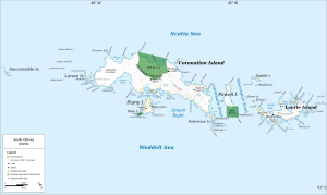
Map of Coronation Island (center) with Iceberg Bay |
||
| Waters | Orwell Bight | |
| Land mass | Coronation Island , South Orkney Islands | |
| Geographical location | 60 ° 39 ′ 0 ″ S , 45 ° 32 ′ 0 ″ W | |
|
|
||
| width | 5 km | |
The Iceberg Bay (English for iceberg bay ) is a 5 km wide bay on the south coast of Coronation Island in the archipelago of the South Orkney Islands . It lies between Cape Hansen and Olivine Point .
The Scottish navigator Matthew Brisbane (1787–1833), captain of the Beaufroy of London during James Weddell's third Antarctic voyage (1822–1824), made a rough map of the south coast of Coronation Island in 1823 and named the bay descriptively.
Web links
- Iceberg Bay in the Geographic Names Information System of the United States Geological Survey (English)
- Iceberg Bay on geographic.org (English)

