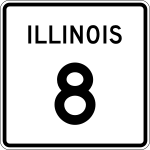
Illinois State Route 8

|
|
|---|---|
| Basic data | |
| Overall length: | 45.51 mi / 73.24 km |
| Opening: | 1918 |
| Starting point: |
|
| End point: |
|
| Counties: |
Knox County Peoria County Tazewell County |
| Important cities: |
Elmwood Peoria East Peoria |
The Illinois Route 8 (short- IL 8 is) a State Route in the State of Illinois , the east-west direction is in.
The State Route begins on Illinois State Route 97 south of Maquon and ends 45 miles west of Washington on US Highway 24 .
course
From IL 97, Illinois State Route 8 runs east. In the center of Elmwood , State Route 78 uses the route of the IL 8. Between Elmwood and Peoria it runs parallel to Interstate 74 and US Highway 150 . Through the underpass under Interstate 474 , it reaches the greater Peoria area.
In the center of Peoria, IL 8 passes Bradley University and meets US Highway 24 . Together with Illinois State Routes 29 and 116 , it crosses the Illinois River on the Cedar Street Bridge . On Main Street they split again and after crossing the I-74 in East Peoria , the IL 8 uses the route of the US Highway 150 for about 500 meters. It leaves the city in an easterly direction and ends west of Washington on the US Highway 24.
See also
Web links
- Illinois Highway Ends (English)
- Illinois Highways (English)