Inčukalns
| Inčukalns ( German : Hinzenberg) | ||
|---|---|---|
 |
|
|
| Basic data | ||
| State : |
|
|
| Landscape: | Livonia ( Latvian : Vidzeme ) | |
| Administrative district : | Inčukalna novads | |
| Coordinates : | 57 ° 6 ' N , 24 ° 41' E | |
| Residents : | 4,531 (Jul 1, 2018) | |
| Area : | ||
| Population density : | ||
| Height : | 52 m | |
| Website: | www.incukalns.lv | |
| Post Code: | ||
| ISO code: | ||
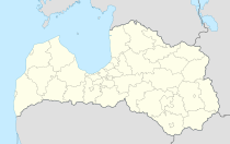
Inčukalns ( German Hinzenberg ) is a village and municipality in Latvia , about 40 km northeast of Riga , and the center of the administrative district of the same name. In 2018 Inčukalns had 4531 inhabitants.
history
The place arose around the Hinzenberg estate. An economic upswing began in the 1880s after Hinzenberg had received a "half-station" (stop) on the Riga – Valmiera railway line . Even in the Soviet era, the place expanded through the settlement of industry and an animal breeding station.
Inčukalna novads
In 2006 the municipality of Inčukalns and the city of Vangaži merged to form an administrative district (Latvian: novads ). (See also: Administrative division of Latvia )
literature
- Hans Feldmann , Heinz von zur Mühlen (ed.): Baltic historical local dictionary, part 2: Latvia (southern Livonia and Courland). Böhlau, Cologne 1990, ISBN 3-412-06889-6 , pp. 218-219.
- Astrīda Iltnere (ed.): Latvijas Pagasti, Enciklopēdija. Preses Nams, Riga 2002, ISBN 9984-00-436-8 .
Web links
Commons : Inčukalns - collection of images, videos and audio files
Footnotes
- ↑ Latvijas iedzīvotāju skaits pašvaldībās (= population figures of the self-governing districts of Latvia), as of July 1, 2018 (Latvian), p. 8, accessed on January 5, 2019.
- ↑ Newspaper of the Association of German Railway Administrations, year 1886, p. 1069.
