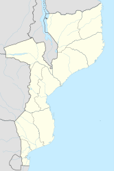
Inhaminga
| Inhaminga | ||
|---|---|---|
|
|
||
| Coordinates | 18 ° 25 ′ S , 35 ° 1 ′ E | |
| Basic data | ||
| Country | Mozambique | |
| Sofala | ||
| District | Cheringoma | |
| ISO 3166-2 | MZ-S | |
| height | 314 m | |
Inhaminga is a village in Mozambique and the capital of the Cheringoma district in the Sofala province .
history
Inhaminga suffered from fighting during the civil war in Mozambique (1976-1992). The railway junction in Inhaminga, which was destroyed in the war, has not yet been restored, and the previously developed timber industry has also not yet recovered from the consequences of the war. Large areas of the region are mined to this day.
Economy and Infrastructure
The place has an airfield ( IATA airport code IMG) with a 900 m long runway. It is about 330 m above sea level .
sons and daughters of the town
- Ungulani Ba Ka Khosa (* 1957), Mozambican writer.
