Iro lake
| Iro lake | ||
|---|---|---|

|
||
| Geographical location | Moyen-Chari region ; Chad | |
| Tributaries | Salamat | |
| Drain | none | |
| Islands | no | |
| Places on the shore | Boum Kabir | |
| Location close to the shore | At Timan | |
| Data | ||
| Coordinates | 10 ° 6 ′ 0 ″ N , 19 ° 25 ′ 0 ″ E | |
|
|
||
| Altitude above sea level | 386 m | |
| surface | 110 km² | |
| length | 13 km | |
| width | 11 km | |
|
particularities |
||
The Iro Lake is a lake in central Africa.
location
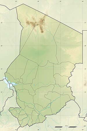
The temporarily water-bearing lake is located in an inland delta in the Moyen-Chari region in southeastern Chad . The Iro Lake is approx. 387 meters above sea level and covers an area of approx. 100 km² on average. The lakeshore is covered by herbaceous vegetation.
Ecological importance
There is little human influence on the lake, but it is an important fishing center in the region, so 1000 tons of fish are caught each year in the lake and in the adjacent floodplains of the Salamat. The Iro Lake has been part of the Ramsar area Plaines d'inondation des Bahr Aouk et Salamat since 2006 , which is of supraregional importance and is one of the largest protected areas of this type worldwide.
Water balance
In the summer and autumn months, it is fed by the eastern arm of the Salamat , which forks seven kilometers southwest of the lake. The lake is about 100 kilometers north of the border with the Central African Republic . It is almost oval, 15 kilometers long and 7 kilometers wide. During longer dry periods the lake can fall completely dry.
source
- Ramsar information about Chad Country information Chad on Ramsar Wetland ( Memento from September 24, 2012 in the Internet Archive ) (English) 172 kB PDF
- The Annotated Ramsar List: Chad. In: archive.ramsar.org. January 14, 2002, accessed August 2, 2018 .
