
Moyen-Chari region
| Moyen-Chari | |
|---|---|
  |
|
| Basic data | |
| Country | Chad |
| Capital | Sarh |
| Residents | 588,008 (2009) |
| ISO 3166-2 | TD-MC |
Coordinates: 9 ° 20 ' N , 18 ° 22' E
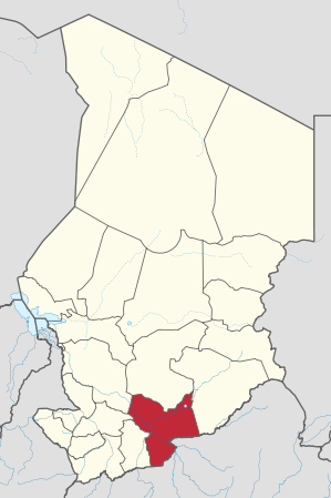
Moyen-Chari (German Mittel- Schari ) is a region of Chad and corresponds to a large part of the former prefecture of the same name, the southern part of which has been the Mandoul region since 2002 . Their capital is Sarh . The region has about 588,008 inhabitants.
geography
Moyen-Chari is located in the south of the country, covers an area of 45,180 km² and borders the Central African Republic . The region is named after the river Schari , on whose banks the Manda National Park extends. Lake Iro lies in the wetlands of the Bahr Salamat River . The wetlands have been part of the Ramsar Plaines d'inondation des Bahr Aouk et Salamat since 2006 , which is one of the world's largest protected areas of this species.
Another city besides Sarh is Kyabé . Moyen-Chari is divided into the three départements Barh Kôh (capital Sarh), Grande Sido (Maro) and Lac Iro (Kyabé).
population
The most important ethnic group in Moyen-Chari are the Sara .
economy
The population in Moyen-Chari lives mainly from subsistence farming , animal husbandry, fishing, and cotton and sugar cane cultivation.
swell
- ↑ Chad: Regions, Cities & Urban Places - Population Statistics in Maps and Tables. Retrieved May 8, 2018 .
- ↑ bevölkerungsstatistik.de (2006)
- ↑ This figure, like the population, includes today's Mandoul region, as bevölkerungsstatistik.de still uses the classification before 2002.
Barh El Gazel |
Batha |
Borkou |
Chari-Baguirmi |
Ennedi
(divided into Ennedi-Est
and Ennedi-Ouest since 2012 ) |
Guéra |
Hadjer Lamis |
Kanem |
Lac |
Logone Occidental |
Logone Oriental |
Mandoul |
Mayo Kebbi Est |
Mayo-Kebbi Ouest |
Moyen-Chari |
Salamat |
Sila |
Tandjilé |
Tibesti |
Wadai |
Wadi Fira
and Ville de N'Djamena