
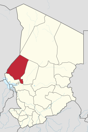
Kanem region
| Kanem | |
|---|---|
  |
|
| Basic data | |
| Country | Chad |
| Capital | Mao |
| surface | 114,520 km² |
| Residents | 388,000 (2006 calculation) |
| density | 3.4 inhabitants per km² |
| ISO 3166-2 | TD-KA |
Coordinates: 14 ° 12 ' N , 15 ° 7' E
Kanem is a region of Chad . Their capital is Mao . The region has around 481,000 inhabitants (as of 2019).
geography
Kanem has an area of 114,520 km² and is located in the west of the country, on the border with Niger .
history
- The Kanem Empire was founded in pre-Christian times .
- From the 13th century on, the empire was called Kanem-Bornu .
- From 1910 to 1935, at the beginning of the French colonial era, Kanem was a "Circonscription" and comprised the six subdivisions Mao , Bol , Rig-Rig , Moussoro , Massakory and Ngouri . The area corresponds to today's Kanem region plus the three neighboring regions to the west, south and east.
- since 1935 the area around Massakory , today's Hadjer-Lamis region , no longer belongs to Kanem.
- from 1935 to 1937 Kanem was combined with the east bordering Batha to form the Kanem-Batha department . The capital was no longer Mao , but Moussoro, further east .
- from 1937 to 1947 the two departments were separated again. Moussoro remained the capital of the Kanem department .
- from 1947 to 1960 Kanem was called a "region". The capital has been Mao again since then .
- since 1960 the area around Bol , today's Lac region , no longer belongs to Kanem . As a result, Kanem is no longer on Lake Chad .
- from 1960 to 1999 Kanem was one of 14 prefectures in Chad. Their three sub-prefectures were Mao , Moussoro and Nokou .
- from 1999 to 2002 Kanem was one of 28 "Départements". The prefectures were dissolved. The eastern part of the former prefecture around Moussoro became a separate department under the name Barh El Gazel .
- Kanem has been a region of Chad since 2002 .
- From 2002 to 2008 the Kanem region was still divided into the two departments Kanem and Barh El Gazel , the borders corresponded to the former prefecture.
- In 2008 the Barh El Gazel department was upgraded to a region and has not belonged to Kanem since then .
- since 2008 the Kanem region has its current borders.
Breakdown
Kanem is divided into three departments ( départements ):
| department | main place | Sub-prefectures |
|---|---|---|
| Kanem | Mao | Mao, Kekedina, Melea, Wadjigui |
| North Kanem | Nokou | Nokou, Rig Rig, Ziguey, Ntiona |
| Wadi Bissam | Mondo | Mondo, Am Doback |
population
Daza ( Tubu ), Kanembu and Chadian Arabs live in Kanem .
Individual evidence
Barh El Gazel |
Batha |
Borkou |
Chari-Baguirmi |
Ennedi
(divided into Ennedi-Est
and Ennedi-Ouest since 2012 ) |
Guéra |
Hadjer Lamis |
Kanem |
Lac |
Logone Occidental |
Logone Oriental |
Mandoul |
Mayo Kebbi Est |
Mayo-Kebbi Ouest |
Moyen-Chari |
Salamat |
Sila |
Tandjilé |
Tibesti |
Wadai |
Wadi Fira
and Ville de N'Djamena