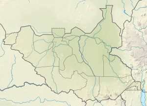
Iro (South Sudan)
| Iro | ||
|---|---|---|
| height | 1091 m | |
| location | Eastern Equatoria , South Sudan | |
| Coordinates | 4 ° 11 '24 " N , 32 ° 20' 5" E | |
|
|
||
Iro is a 1091 m high mountain in South Sudan in the state of Imatong in the "province" of Equatoria . It is located in the south-east of the country, approx. 110 km south-east of the capital Juba . Before the reorganization of the state in 2015, it was in the area of Eastern Equatoria .
geography
The mountain is located west of the Imatong Mountains and is largely free in the landscape. The next notable mountains in the area are Alue (Aluz, 1212 m ⊙ ), Loghobok (Logorobok, 832 m, ⊙ ), Fogha (1010 m ⊙ ), Magwe (886 m, ⊙ ) and Onderi ( ⊙ ), foothills of the Acholi - mountain range. The Iro itself reaches a height of 1091 m .
The important connecting road to the Kenyan border town of Lokichoggio runs southwest of the mountain via Torit and Magwi .
