Isla Natividad
| Isla Natividad | ||
|---|---|---|
| The village of Natividad | ||
| Waters | Pacific Ocean | |
| Geographical location | 27 ° 51 ′ 9 ″ N , 115 ° 10 ′ 9 ″ W | |
|
|
||
| length | 7.1 km | |
| width | 2.9 km | |
| surface | 8.665 km² | |
| Highest elevation | 150 m | |
| Residents | 302 (2010) 35 inhabitants / km² |
|
| main place | Natividad | |
| Satellite map | ||
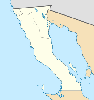
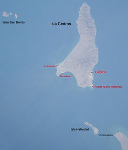
Isla Natividad is an arid Mexican island in the Pacific Ocean 6 km from Punta Eugenia on the northwestern headland of the state of Baja California Sur , separated from it by the Canal de Deway , and 15 km south of Isla de Cedros . The island is bare and hilly.
Isla Natividad belongs to the municipality of Mulegé , is 7.1 km long and a maximum of 2.9 km wide in the southeast, and reaches a height of 150 meters in the center. It is 8.665 km² and counted 302 inhabitants in the 2010 census, mainly fishermen for abalones , lobsters , lobsters and mussels in the village of Natividad in the southeast. The 7.4 hectare rock ridge Roca Maria lies 200 m off the northwest coast . In the north of the island there is a lighthouse , in the southeast the village of the same name and a landing strip .
The mining of guano was particularly important on Natividad in the 1940s . Today the island is part of the El Vizcaíno Biosphere Reserve . But it is also considered a good surfing area.


