Itilima (district)
| Itilima district
|
||
|---|---|---|
| Basic data | ||
| Country | Tanzania | |
| region | Simiyu | |
| surface | 2648 km² | |
| Residents | 313,900 (2012) | |
| density | 119 inhabitants per km² | |
| ISO 3166-2 | TZ-30 | |
Coordinates: 2 ° 58 ′ S , 34 ° 9 ′ E
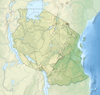
Itilima is a district in the Tanzanian region of Simiyu with the administrative center in Lagangabilili . Itilima is bordered by the Bariadi district to the north, the Arusha region to the east, the Meatu and Maswa districts to the south, and the Mwanza region to the northwest .
geography
The district of Itilima is 2648 square kilometers and has 313,900 inhabitants (as of 2012). The Maswa Game Reserve accounts for 640 square kilometers of the area. Almost 2,000 square kilometers are arable land or pasture. Itilima's climate is tropical. The annual rainfall is between 700 and 950 millimeters. There are two rainy seasons. Short rain showers fall from October to December, from March to May there are longer periods of rain. From June to September it is hot and dry. The average temperature is 29 degrees Celsius during the day and 19 degrees at night.
history
In 2012, the Simiyu region was founded with the Itilima district.
Administrative division
Itilima is divided into the four districts (divisions) Kanadi, Bumera, Itilima and Kinang'weli and 22 parishes (wards):
- Budalabujiga
- Bumera
- Chinamili
- Ikindilo (Ikindiro)
- Kinang'weli
- Lagangabilili
- Lugulu
- Mbita
- Coin
- Migato
- Mwalushu
- Mwamapalala
- Mwamtani
- Mwas whales
- Ndolelezi
- Nhobora
- Nkoma
- Nkuyu
- Nyamalapa
- Sagata
- Sawida
- Zagayu
populationThe largest ethnic group in Itilima are the Sukuma , also called Ntuzu. Nyiramba, Kulya, Kerewe, Zanaki, Waha and Nyamwezi also live in the district. Of those over five years of age, 48 percent could read and write Swahili and four percent English and Swahili, 48 percent were illiterate (as of 2012). |
 |
Facilities and services
- Education: There are 113 primary schools in the district and there are 46 students for every teacher. Of the thirty secondary schools, 29 are state-run and one is private. There are no high schools in the district.
- Health: There are three health centers and 29 pharmacies available for medical care for the population (as of 2012).
- Water: Just under sixty percent of the population have access to clean water (as of 2012).
Economy and Infrastructure
|
 |
Web links
Individual evidence
- ^ A b c d e Itilima District Council, Strategic Plan. (pdf) The United Republic of Tanzania, July 2015, p. 6 , accessed on November 10, 2019 .
- ↑ Itilima District Council Strategic Plan. (pdf) The United Republic of Tanzania, July 2015, p. 7 , accessed on November 10, 2019 .
- ↑ City population, Tanzania's Lake Zone, Itilima. February 4, 2017, accessed November 10, 2019 .
- Jump up ↑ Tanzania Regional Profiles, 24 Simiyu Regional Profiles. (pdf) The United Republic of Tanzania, 2016, p. 72 , accessed on November 8, 2019 .
- ↑ Primary education | Itilima District Council. Retrieved November 11, 2019 .
- ↑ Reports | Itilima District Council. P. 10 , accessed on November 11, 2019 .
- ↑ a b Itilima District Council Strategic Plan. (pdf) The United Republic of Tanzania, July 2015, p. 11 , accessed on November 10, 2019 .
- ↑ Regional newsletter. (pdf) Simiyu Region, February 15, 2017, pp. 5–6 , accessed on November 11, 2019 (Swahili).
- Jump up ↑ Tanzania Regional Profiles, 24 Simiyu Regional Profiles. (pdf) The United Republic of Tanzania, 2016, pp. 129, 131 , accessed on November 8, 2019 .
- ↑ Works | Itilima District Council. Retrieved November 11, 2019 .
- ^ Trunk Roads Network. Retrieved November 11, 2019 .

