Busega (District)
| Busega district
|
||
|---|---|---|
| Basic data | ||
| Country | Tanzania | |
| region | Simiyu | |
| surface | 1312 km² | |
| Residents | 203,597 (2012) | |
| density | 155 inhabitants per km² | |
| ISO 3166-2 | TZ-30 | |
Coordinates: 2 ° 23 ' S , 33 ° 33' E
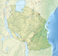
Busega is a district in the Tanzanian region of Simiyu with the administrative center in Nyashimo . Busega is bordered by the Mara region to the north, the Bariadi district to the east and south, the Mwanza region to the southwest and Lake Victoria to the west .
geography
The Busega district is 1312 square kilometers and has around 200,000 inhabitants (as of 2012). The district is located in the northwest of the Simiyu region directly on Lake Victoria. It has annual rainfall of 700 to 900 millimeters and is well suited for arable farming and cattle breeding.
history
Busega was founded in 2012 with the separation from Magu District and became part of the newly established Simiyu Region.
Administrative division
The district is divided into thirteen parishes (wards):
| Ward | Residents
2012 |
Household
size |
Men too
100 women |
|---|---|---|---|
| Shigala | 12,974 | 6.4 | 96 |
| Badugu | 13,571 | 6.6 | 94 |
| Nyaluhande | 9,688 | 6.7 | 98 |
| Kiloleli | 19,396 | 5.6 | 93 |
| Mwamanyili | 15,224 | 5.3 | 91 |
| Kabita | 22,772 | 5.2 | 89 |
| Kalemela | 10,928 | 6.0 | 94 |
| Lamadi | 22,062 | 5.1 | 93 |
| Lutubiga | 11,721 | 7.4 | 99 |
| Mkula | 16,821 | 6.9 | 93 |
| Ngasamo | 18,935 | 7.2 | 98 |
| Malili | 17,084 | 6.5 | 95 |
| Igalukilo | 12,421 | 6.4 | 94 |
populationIn 2002, Busega was home to 170,649 people. The increase to 230,597 in 2012 corresponds to a population growth of 19.3 percent. During the same period, the literacy rate rose from 65 percent to 77 percent. Sixty percent of those over five could read and write Swahili, one percent English, and eight percent English and Swahili, 31 percent were illiterate (as of 2012). |
 |
Facilities and services
- Education: There are 91 elementary schools in the district, 86 of which are state-run and five are public. 82 percent of young people between the ages of seven and thirteen attended school, 80 percent of boys and 84 percent of girls.
- Health: There are two government health centers and over 20 pharmacies in Busega.
- Water: 39 percent of the population have access to clean water.
Economy and Infrastructure
|
 |
- Mining: In 2011, nickel ore was found in Mount Ngasamo, with deposits estimated at eleven million tons. After test drilling, a mining contract was canceled by the Tanzanian government in 2017.
- Roads: There are two well-developed and asphalted main roads in Busega: the national road T4 from Mwanza to Musoma crosses the district from south to north and the trunk road T36 branches off in Lamadi and leads to Bariadi.
Web links
Individual evidence
- ^ A b c Tanzania Regional Profiles, 24 Simiyu Regional Profiles. (pdf) The United Republic of Tanzania, 2016, p. 16 , accessed on November 8, 2019 .
- ↑ Tanzania: Lake Zone (Districts and Wards) - Population Statistics, Charts and Map. Retrieved November 8, 2019 .
- ↑ Simiyu Investment Guide. (pdf) The United Republic of Tanzania, March 16, 2017, p. 6 , accessed on November 9, 2019 .
- ↑ History | BUSEGA DISTRICT COUNCIL. Retrieved November 8, 2019 .
- ↑ 2012 Population and Housing Census. (pdf) National Bureau of Statistics Ministry of Finance Dar es Salaam, March 2013, p. 217 , accessed on November 9, 2019 .
- Jump up ↑ Tanzania Regional Profiles, 24 Simiyu Regional Profiles. (pdf) The United Republic of Tanzania, 2016, pp. 16, 69, 72 , accessed on November 8, 2019 .
- ↑ a b c d e f Category publications | Simiyu region. (pdf) pp. 11–12 , accessed on November 9, 2019 (Swahili).
- Jump up ↑ Tanzania Regional Profiles, 24 Simiyu Regional Profiles. (pdf) The United Republic of Tanzania, 2016, p. 83 , accessed on November 8, 2019 .
- Jump up ↑ Tanzania Regional Profiles, 24 Simiyu Regional Profiles. (pdf) The United Republic of Tanzania, 2016, pp. 129, 131 , accessed on November 8, 2019 .
- ↑ Kijereshi Game Reserve. Retrieved November 9, 2019 .
- ^ How JPM order hits the World Bank, UK. (pdf) The Citizen, January 13, 2017, accessed November 9, 2019 .


