Bariadi (district)
| Bariadi district | |
|---|---|
 Location of the Bariadi district in Tanzania |
|
| Basic data | |
| Country | Tanzania |
| region | Simiyu |
| surface | 5968 km² |
| Residents | 422,916 (2012) |
| density | 71 inhabitants per km² |
| ISO 3166-2 | TZ-30 |
Coordinates: 3 ° 20 ′ S , 35 ° 21 ′ E
Bariadi is a district in the Tanzanian region of Simiyu with the administrative center in the city of Bariadi . The district borders in the north on the Mara region , in the east on the Arusha region , in the south on the districts Itilima and Maswa and in the west on the Mwanza region and the Busega district .
geography
|
Bariadi is 5968 square kilometers and has around 420,000 inhabitants (as of 2012). The district is located in the north of the Simiyu region and has large agricultural areas. The Serengeti National Park and the Maswa Game Reserve make up a large part of the country's area . Administrative divisionThe district includes the two councils Bariadi-Land (DC) and Bariadi-City (TC) and is divided into the three districts (divisions) Mhango, Dukwa and Nkolol and 25 parishes (wards): |
 |
| Ward | Residents
2012 |
|---|---|
| Nkindwabiye | 13,948 |
| Mwaubingi | 15,780 |
| Nkololo | 21,776 |
| Mwaumatondo | 25,748 |
| Mwadobana | 25,778 |
| Nyangokolwa | 22,557 |
| Somanda | 16,592 |
| Bunamhala | 28.301 |
| Sakwe | 25,676 |
| Ngulyati | 11,462 |
| Mhango | 11,253 |
| Kilalo | 9,953 |
| Kasoli | 14,442 |
| Gambosi | 15,047 |
| Guduwi | 10,550 |
| Ikungulyabashashi | 10.153 |
| Nyakabindi | 19,723 |
| Dutwa | 15,792 |
| Sapiwi | 19,356 |
| Matongo | 26,267 |
| Gilya | 16,118 |
| Isanga | 11,354 |
| Bariadi | 11,248 |
| Malambo | 10,489 |
| Sima | 13,553 |
population
The majority of the population belongs to the Sukuma ethnic group . Of the 422,916 inhabitants in 2012, 201,718 were men and 221,198 were women, which results in a gender ratio of 91 men to 100 women. The average household size was 7.1 people. Of those over five years of age, 49 percent could read and write Swahili and six percent English and Swahili, 45 percent were illiterate (as of 2012).
Facilities and services
- Education: There are 73 elementary schools in the district, all of which are state-run. Of the 23 secondary schools, 22 are public and one is privately run (as of 2012). 63 percent of young people between the ages of seven and thirteen attended school, 60 percent of boys and 66 percent of girls.
- Health: There are two health centers and 25 pharmacies in Bariadi. Seven percent of the population had social security (as of 2012).
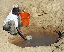
- Water: 42 percent of the population have access to clean water.
Economy and Infrastructure
|
 |
Web links
Individual evidence
- ↑ a b c d e f g h i j Regional newsletter. (pdf) The United Republic of Tanzania, Regional Administration, February 15, 2015, accessed November 7, 2019 (Swahili).
- ↑ a b 2012 Population and Housing Census. (pdf) The United Republic of Tanzania, March 2013, p. 213 , accessed on November 8, 2019 .
- Jump up ↑ Tanzania Regional Profiles, 24 Simiyu Regional Profiles. (pdf) The United Republic of Tanzania, 2016, p. 72 , accessed on November 8, 2019 .
- Jump up ↑ Tanzania Regional Profiles, 24 Simiyu Regional Profiles. (pdf) The United Republic of Tanzania, 2016, p. 83 , accessed on November 8, 2019 .
- Jump up ↑ Tanzania Regional Profiles, 24 Simiyu Regional Profiles. (pdf) The United Republic of Tanzania, 2016, pp. 125–126 , accessed on November 8, 2019 .
- Jump up ↑ Tanzania Regional Profiles, 24 Simiyu Regional Profiles. (pdf) The United Republic of Tanzania, 2016, pp. 129, 131 , accessed on November 8, 2019 .
- ^ African Eagle Resources. Retrieved November 8, 2019 .
- ↑ Drilling completed at Harmony's Dutwa Nickel Project, targeting historical nickel sulphide mineralization | Harmony Minerals. Retrieved November 8, 2019 .
- ^ Trunk Roads Network. (pdf) Accessed November 7, 2019 .


