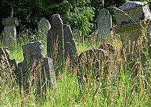
Jewish cemetery (raft)
The Jewish cemetery Floß in Floß , a municipality in the Upper Palatinate district of Neustadt an der Waldnaab ( Bavaria ), is located on a hill northeast of the village, on the right on the road to Flossenbürg .
history
The Jewish community of Floß built their own cemetery in 1692 , i. H. seven years after the settlement permit for the first Jews in Floß.
The cemetery was also used by the Jewish communities in Schönsee , Waidhaus and, until 1901, by the Jewish community in Weiden . The cemetery was enlarged in 1729, 1754 and 1780 and the cemetery area is 7.50 acres . In 1775 a granite wall was built around the cemetery, which was expanded in 1778 and 1842. Today around 400 tombstones ( Mazewot ) are still preserved and the oldest is from 1692. The last burial took place in 1946.
Desecrations
The cemetery was desecrated before the Nazi era at the end of October 1929. Desecrations also took place after 1945; 44 tombstones were knocked over in August 1997.
literature
- Klaus-Dieter Alicke: Lexicon of the Jewish communities in the German-speaking area. Volume 1: Aach - Groß-Bieberau. Gütersloher Verlagshaus, Gütersloh 2008, ISBN 978-3-579-08077-2 ( online version ).
- Renate Höpfinger: The Jewish community of Floß 1684-1942. The story of a rural Jewish community in Bavaria. Kallmünz, Lassleben 1993, ISBN 3-7847-4014-6 , ( Regensburg Historical Research 14), (At the same time: Regensburg, Univ., Diss., 1991),
- Israel Schwierz: Stone evidence of Jewish life in Bavaria. A documentation . Published by the Bavarian State Center for Political Education in Munich. Bayerische Verlags-Anstalt, Bamberg 1988, ISBN 3-87052-393-X , pp. 273-274.
- More than stones ... Synagogue memorial band Bavaria. Volume I . Edited by Wolfgang Kraus, Berndt Hamm and Meier Schwarz . Developed by Barbara Eberhardt and Angela Hager with the assistance of Cornelia Berger-Dittscheid, Hans Christof Haas and Frank Purrmann. Kunstverlag Josef Fink, Lindenberg im Allgäu 2007, ISBN 978-3-89870-411-3 , pp. 244-252.
Web links
- Jewish cemetery raft near Alemannia Judaica (with many photos)
- [1] raft. In: Overview of all projects for the documentation of Jewish grave inscriptions in the area of the Federal Republic of Germany. Bavaria. Editor: Felicitas Grützmann, Central Archive for Research into the History of Jews in Germany , 2010
- Jewish cemeteries in Bavaria: raft
- [2] The House of Bavarian History on the Jewish fallen soldiers of the First World War on the war memorial in Floss
Individual evidence
- ↑ Medienhaus Der Neue Tag: Wall rebuilt: excavator at the cemetery. In: onetz.de. Retrieved June 1, 2016 .
Coordinates: 49 ° 43 ′ 31 ″ N , 12 ° 17 ′ 7 ″ E

