Jaarsmoorgraben
| Jaarsmoorgraben | ||
|
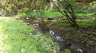
Mouth of the Jaarsmoorgraben in the Mühlenau |
||
| Data | ||
| location | Hamburg-Eidelstedt | |
| River system | Elbe | |
| Drain over | Mühlenau → Kollau → Tarpenbek → Alster → Elbe → North Sea | |
| source | East of Alpenrosenweg 53 ° 36 ′ 37 ″ N , 9 ° 53 ′ 2 ″ E |
|
| muzzle | at the Wiebelstrasse playground in Mühlenau Coordinates: 53 ° 36 '18 " N , 9 ° 54' 30" E 53 ° 36 '18 " N , 9 ° 54' 30" E
|
|
| length | 2.1 km | |
| Big cities | Hamburg | |
| Navigable | No | |
The Jaarsmoorgraben is a 2.1 km long, almost completely cased trench in Hamburg-Eidelstedt .
The only freely visible place is the last section before the confluence with the Mühlenau at the Wiebelstraße playground.
Jaarsmoor
The Jaarsmoorgraben is named after the Jaarsmoor formerly located between Eidelstedt and Schenefeld.
The formation of the Jaarsmoors began about 6000 years ago. Digested sludge from dead plankton organisms became the breeding ground for the cane grass vegetation, which covered lakes without drainage, sank to the ground and deepened.
The Jaarsmoor disappeared as a result of the construction of the Eidelstedt marshalling yard and the construction of settlements.
Individual evidence
- ↑ Complete list of rivers in the Elbe catchment area. Retrieved June 30, 2020 .
- ↑ Zoning plan Eidelstedt 53 Hamburg - MetaVer. Retrieved June 30, 2020 .
- ↑ Otto Hintze: History of Eidelstedt. Eidelstedter Bürgererverein, September 2007, accessed on July 14, 2020 .
