
Kollau (Tarpenbek)
|
Kollau Collau, Coldelowe |
||
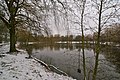
 The Kollau flows into the Tarpenbek in May 2008. |
||
| Data | ||
| location | Hamburg , Germany | |
| River system | Elbe | |
| Drain over | Tarpenbek → Alster → Elbe → North Sea | |
| source | Ditch to the Kollauteich in Hamburg - Schnelsen 53 ° 38 ′ 18 ″ N , 9 ° 55 ′ 40 ″ E |
|
| muzzle |
Tarpenbek in Hamburg-Lokstedt Coordinates: 53 ° 36 '20 " N , 9 ° 57' 58" E 53 ° 36 '20 " N , 9 ° 57' 58" E
|
|
| length | 8 kilometers | |
| Catchment area | approx. 10 km² | |
| Right tributaries | Mühlenau (Kollau) , Alte Kollau , Schillingsbek | |
| Big cities | Hamburg | |
| Navigable | No | |
|
Tributaries and hydraulic structures
|
|||||||||||||||||||||||||||||||||||||||||||||||||||||||||||||||||||||||||||||||||||||||||||||||||||
The Kollau is a creek almost eight kilometers long in the north of Hamburg . It rises in the Schnelsen district , flows through Niendorf and Lokstedt and flows into the Tarpenbek on the border with Groß Borstel . The Kollauwanderweg runs along the entire route alongside the brook, and from the Niendorfer Gehege the tracks of the Hamburg freight bypass are added.
Course and tributaries
The Kollau rises on the Vielohweg ( ⊙ ) in Schnelsen and after about 200 meters, together with the Dübwischgraben, forms the “Kollauteich” retention basin ( ⊙ ). The stream then flows south and circles the Niendorf enclosure in a wide loop to the east . At the border to Groß Borstel it flows into the Tarpenbek ( ⊙ ) when coming from the right . With it, the water of the Kollau reaches the Eppendorfer mill pond and from there into the Alster .
The only major tributary is the Mühlenau ( ⊙ ), which comes from Eidelstedt and flows into the Kollau on the right just before the Niendorfer Gehege. In addition, some ditches lead water into the Kollau; shortly before the estuary, the Schillingsbek flows under the freight bypass into the Kollau.
The Kollautich from the east bank

Source of the Kollau at the Vielohteich


History
The Kollau was called Schnelsener Au , later also Langenborn , from the source to the tributary through the Mühlenau around 1789 . The name Kollau was only valid after the (then) confluence with the Mühlenau.
Ecological value
The Hamburg biotope mapping describes the Kollau as a "natural stream with impairments". On the nine-point scale of the biotope assessment, it thus reaches level six. The brook is particularly affected by the regulation: The banks are straight, in some cases with steep slopes and Bongossi barriers. Another devaluation from an ecological point of view is the flood retention basin in the main river, which reduces the patency. A second basin, on the other hand, is laid out in a bypass and is covered with species-rich silting vegetation. Often there is dense vegetation with riparian wood. Riverside reeds occur sporadically, in sunny areas there are aquatic and riverbank perennial communities. The near-natural sections are biotopes worthy of protection within the meaning of Section 28 of the Hamburg Nature Conservation Act. Since 2011, the Kollau has been routed around the Kollau pond in its own, newly designed bed to improve the water quality.
The Kollauer Hof
The Kollauer Hof is the oldest documented settlement in today's Niendorf area. In 1184, the Archbishop of Bremen, Siegfried , determined that the Burstolde Curia on Coldeloghe had to raise an annual contribution of five marks to support the Hamburg cathedral students. The name Coldeloghe first referred to a grain mill that was built on a damming ( Quall ) of the Tarpenbek and a cleared forest meadow ( Lohe ). When the mill was later relocated to the stream that flows further south into the Tarpenbek, the name of the mill was also transferred to the small flowing water.
From 1341 the mill belonged to the Jungfrauenthal monastery . It was later given up in favor of the Eppendorfer Mühle on the Alster. A powder mill was built in its place in 1591 , which was destroyed by an explosion in 1660. However, the powder mill was rebuilt and produced gunpowder until 1773. In the period that followed, the farm alternately served as the summer residence of wealthy Hamburg merchants, an inn and factory premises. The street names Auf dem Kollauer Hof and Bei der Pulvermühle still remember him today .
As namesake
The following streets were named after the Kollau:
- Kollaustraße ( B447 , with bus stop, is crossed by Kollau)
- Alte Kollaustraße (following the course of the old Kollaustraße)
- At the Kollauer Hof (after the Kollauer Hof)
- Kollaukamp
- Lütt Kollau
literature
- Horst Grigat (Ed.): Hamburg-Niendorf from the Stone Age to the present . Self-published, Hamburg 1972
Web links
Individual evidence
- ↑ Otto Hintze: History of Eidelstedt. (PDF) In: Eidelstedter Bürgererverein. Eidelstedter Bürgererverein, 2016, accessed on July 6, 2020 .
- ↑ Streets on the Kollau on Google Maps. Retrieved August 14, 2020 (de-US).