Jahorlyzkyj Bay
| Jahorlyzkyj Bay Ягорлицька затока (Jahorlyzka satoka) |
||
|---|---|---|
| Waters | Black Sea | |
| Land mass | Eastern Europe | |
| Geographical location | 46 ° 24 ′ N , 31 ° 52 ′ E | |
|
|
||
| width | 15 km | |
| depth | 26 km | |
| Greatest water depth | 5 m | |
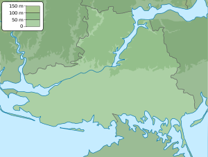
The Jahorlyzkyj Bay ( Ukrainian Ягорлицька затока / Jahorlyzka satoka ) is a shallow bay on the Ukrainian Black Sea coast.
The bay is located between the Kinburn Peninsula in the north and the Jahorlyzkyj Kut Peninsula ( Ягорлицький Кут ) in the south. From the open sea in the west it is partly separated by the two small islands Long Island ( Довгий острів ) and Round Island ( Круглий острів ), which formerly formed the southern part of the Kinburn Spit .
The bay is part of the Black Sea Biosphere Reserve and a Ramsar area in southern Ukraine. It is 26 km long, up to 15 km wide and 5 meters deep. In the northwest, the Jahorlyzkyj Bay borders on the Mykolaiv Oblast and in the northeast, east and south on the Kherson Oblast .
An expedition of the Institute for Underwater Cultural Heritage (from the Institute of Archeology of the National Academy of Sciences of Ukraine ) found the remains of a 2,700-year-old Greek settlement at the bottom of the bay .
Individual evidence
- ↑ Jahorlyzkyj Bay, Black Sea ( Memento of the original from November 27, 2015 in the Internet Archive ) Info: The archive link was inserted automatically and has not yet been checked. Please check the original and archive link according to the instructions and then remove this notice. on Ivanovka.pro, accessed July 31, 2015
- ↑ "The ruins of the ancient settlement flooded by the sea on fakty.ua, accessed July 31, 2015


