Javořice
| Javořice
Jaborschützberg
|
||
|---|---|---|
|
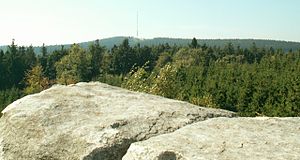
View from the Míchova skála to Javořice |
||
| height | 837 m nm | |
| location | Czech Republic | |
| Mountains | Iglauer Berge | |
| Coordinates | 49 ° 13 '16 " N , 15 ° 20' 22" E | |
|
|
||
| rock | granite | |
The Javořice (German Jaborschützberg , also Ahornberg ) is a mountain in the Czech Republic . It is located five kilometers northeast of Studená and ten kilometers northwest of Telč . At 837 m, it forms the highest elevation of the Jihlava Mountains (Jihlavské vrchy) and the entire Bohemian-Moravian Highlands .
The 166 m high Javořice transmitter is located on the summit, which is lined with coniferous forests .
To the northwest are the secondary peaks Stříbrný vrch (759 m) and Velký Skalní vrch (785 m). In the northeast lies the Michův vrch ( Michelberg ; 786 m) and two rock towers of the Míchova skála ( Michowa Skala ) with a height of 13 m. In the east near Lhotka lies the Vrch (726 m) with the remains of the Štamberk Castle . The southeastern Vorgipfel Široký kámen (720 m) offers a good view of Telč ( Telč ).
At the pond Velký pařezitý rybník below the Míchova skála near Řásná , a car camp site was built. Another campsite is located by the Horní Mrzatec pond near Lhotka. The at the western foot Klatovec ( Klatowetz location) Pond Zhejral is a nature reserve.
The Studánka Páně spring is located on the northwest slope 500 m below the summit. Not far from there rises the Studenský potok, which flows through the Zelená údolí ( Green Ground ) into the Zhejral.
Web links
- http://www.jiznicechy.org/cz/index.php?path=prir/javorice.htm (Czech and English)
- http://www.pira.cz/foto/fotojav.htm (Czech)


