Jemez Pueblo
| Jemez Pueblo | |
|---|---|
 Richard H. Kern, lithographer. 1850 |
|
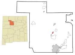
| Location in New Mexico | |
| Basic data | |
| State : | United States |
| State : | New Mexico |
| County : | Sandoval County |
| Coordinates : | 35 ° 37 ′ N , 106 ° 44 ′ W |
| Time zone : | Mountain ( UTC − 7 / −6 ) |
| Residents : | 1,953 (as of: 2000) |
| Population density : | 368.5 inhabitants per km 2 |
| Area : | 5.3 km 2 (approx. 2 mi 2 ) of which 5.3 km 2 (approx. 2 mi 2 ) is land |
| Height : | 1708 m |
| Postal code : | 87024 |
| Area code : | +1 505 |
| FIPS : | 35-35250 |
| GNIS ID : | 0928742 |
Jemez Pueblo is the main settlement or pueblo ("village") of the Jemez Pueblo (Hį: mįsh) in Sandoval County in the US state of New Mexico .
The traditional name is Walatowa ("This is the [correct] place"), but the settlement (pueblo) is better known under the name Jemez Pueblo ("Village of the Jemez Pueblo (Hį: mįsh)") and has around 1,953 inhabitants inhabited.
The pueblo forms the center of the approximately 5.3 km² Jemez reservation, which borders directly on the neighboring Zia reservation with the pueblo of the Zia Pueblo . The neighboring community of Jemez Springs , located about twelve miles south , on the Jemez River and in the Jemez Mountains, was named after the nearby Jemez Pueblo.
Web links
Commons : Jemez Pueblo - collection of images, videos and audio files
