Jezioro Budwity
| Jezioro Budwity | ||
|---|---|---|

|
||
| Bauditter lake | ||
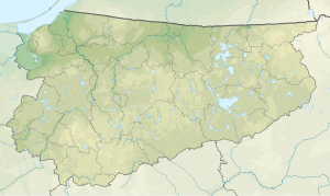
| Geographical location | Małdyty Municipality , Powiat Ostródzki , Warmian-Masurian Voivodeship , Poland | |
| Drain | to Kanał Elbląski | |
| Places on the shore | Budwity | |
| Location close to the shore | Małdyty | |
| Data | ||
| Coordinates | 53 ° 56 '29 " N , 19 ° 39' 25" E | |
|
|
||
| Altitude above sea level | 99.7 m npm | |
| surface | 45.1 ha | |
| length | 1.4 km | |
| width | 470 m | |
| scope | 3.25 km | |
| Maximum depth | 8 m | |
| Middle deep | 3.6 m | |
The Jezioro Budwity (Jezioro Budwickie, Jezioro Piniewo, German Bauditter See ) is a lake north of the village of Budwity , south of the village of Awajki , near the Kanał Elbląski , with which it is connected with a wide stream. The length of the bank is 3250 m.
In the southern part of the lake the lake is fed by a brook from the village of Budwity, in the north a brook drains into the Kanał Elbląski.
The lake has high banks and is surrounded by fields and meadows. The lake is used by Zakład Rybacki Bogaczewo Sp. Z oo as a fishing lake. There are pikeperch , pike and tench .
According to Leyding, the lake had an area of 44.68 hectares.
literature
- Jeziora okolic Olsztyna . Przewodnik wędkarski. No. 2 , 1997.
Individual evidence
- ^ A b Gustaw Leyding : "Nazwy Fizjograficzne" . In: Morąg - z dziejów miasta i powiatu . Olsztyn 1973.
- ↑ January Baldowski: Warmia i Mazury, mały przewodnik . Wydawnictwo Sport i Turystyka, Warszawa 1977, p. 175-176 .
