Jezioro Czarne (Dubeninki)
| Jezioro Czarne | ||
|---|---|---|
| Geographical location |
Poland , Warmian-Masurian Voivodeship |
|
| Tributaries | unnamed | |
| Drain | → Jarka (Upper Goldap) → Gołdapa | |
| Places on the shore | Czarne , Kociołki , Pluszkiejmy , Meszno | |
| Location close to the shore | Gołdap , Dubeninki | |
| Data | ||
| Coordinates | 54 ° 17 ′ 9 ″ N , 22 ° 28 ′ 48 ″ E | |
|
|
||
| surface | 1.73 km² | |
| length | 4 km | |
| width | 300 m | |
| Maximum depth | 23 m | |
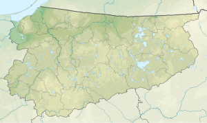
The Jezioro Czarne ("Black Lake", German Czarner See , 1938 to 1945 Scharner See ) is an inland lake in the northeast of the Polish Warmian-Masurian Voivodeship . It is located in the area of the rural municipality Dubeninki (Dubeningken , 1938 to 1945 Dubeningen) in the area of Powiat Gołdapski ( Goldap district ).
The Jezioro Czarne is located on the southern edge of the Rominter Heide (Polish: Puszcza Romincka ) not far from the voivodeship border with Podlachia , which until 1938 formed almost exactly the border between the German Empire and Poland . The main town on Jezioro Czarne is the village Pluszkiejmy (Plautzkehmen , 1938 to 1945 Engern) on the north bank, through which the voivodship road DW 651 leads from Gołdap via Żytkiejmy (Szittkehmen , 1938 to 1945 fortified churches) to Sejny . Czarne (Czarnen , 1938 to 1945 Scharnen) , Kociołki (Kotziolken , 1910 to 1945 Langensee) and Meszno (Meschkrupchen , 1938 to 1945 Meschen) line the southern, northwestern and northeastern shore area.
The lake measures an area of 1.73 km² with a length of 4 and a width of 0.3 kilometers. The maximum depth is 23 meters.
