Jezioro Krzemień
|
Jezioro Krzemień Kremmin Lake |
||
|---|---|---|

|
||
| Jezioro Krzemień (Kremmin Lake) | ||
| Geographical location | Pomeranian Lake District | |
| Tributaries | Ina | |
| Drain | Ina | |
| Places on the shore | Krzemień | |
| Location close to the shore | Dobrzany , Ińsko | |
| Data | ||
| Coordinates | 53 ° 22 '33 " N , 15 ° 32' 22" E | |
|
|
||
| Altitude above sea level | 90.9 m | |
| surface | 2.333 km² | |
| Maximum depth | 29.2 m | |
|
particularities |
||
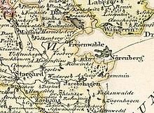
The Jezioro Krzemień ( German Kremminer See ) is an inland lake in the powiat Stargardzki in the Polish West Pomeranian Voivodeship . It is named after the place Krzemień ( Kremmin ) on the south-east bank of the lake. It is located in the municipality of Dobrzany ( Jakobshagen ) and belongs to the Ińsko Landscape Protection Park ( Iński Park Krajobrazowy ).
Geographical location

The Kremminer See is located in Upper Pomerania and belongs to the Pomeranian Lake District . Its height above sea level is 90.9 meters. The towns of Dobrzany and Ińsko ( Nörenberg ) are four and five kilometers away.
The Kremminer See is over 3.4 kilometers long, up to one kilometer wide and 233.35 hectares in size. It is up to 29.2 meters deep.
tourism
The lake is located on the Szlak Wzniesieniami Moreny Czołowej moraine trail , which leads from Dobrzany via Ińsko to Cieszyno ( Teschendorf ).
literature
- Jerzy Kosacki, Bogdan Kucharski: Pomorze Zachodnie i Środkowe. Przewodnik. Warszawa, Sport i Turystyka, 2001. pp. 410-412. ISBN 83-7200-583-4 .
