Insko
| Insko | ||
|---|---|---|

|
|
|
| Basic data | ||
| State : | Poland | |
| Voivodeship : | West Pomerania | |
| Powiat : | Stargard | |
| Area : | 6.95 km² | |
| Geographic location : | 53 ° 26 ' N , 15 ° 33' E | |
| Height : | 111 m npm | |
| Residents : | 1924 (Jun. 30, 2019) |
|
| Postal code : | 73-140 | |
| Telephone code : | (+48) 91 | |
| License plate : | ZST | |
| Economy and Transport | ||
| Street : | Ext. 151 : Świdwin ↔ Gorzów Wielkopolski | |
| Rail route : | no rail connection | |
| Next international airport : | Szczecin-Goleniów | |
| Gmina | ||
| Gminatype: | Urban and rural municipality | |
| Gmina structure: | 18 villages | |
| 7 school offices | ||
| Surface: | 151.01 km² | |
| Residents: | 3350 (Jun. 30, 2019) |
|
| Population density : | 22 inhabitants / km² | |
| Community number ( GUS ): | 3214053 | |
| Administration (as of 2015) | ||
| Mayor : | Jacek Liwak | |
| Address: | ul.Bohaterów Warszawy 38 73-140 Ińsko |
|
| Website : | www.insko.pl | |
Ińsko [ 'iɲskɔ ] (German Nörenberg ) is a town in the Polish West Pomeranian Voivodeship , Powiat Stargardzki ( Stargard district ).
Geographical location

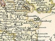
The city is located in Western Pomerania , 40 km east of Stargard on the border with Neumark on the southern bank of Lake Enzig ( Jezioro Ińsko ).
history

The exact time when the city was founded is not known. It should be after 1248, because when the Marienfließ monastery was founded , Duke Barnim I furnished it with lands that reached as far as Lake Enzig, but were largely uninhabited at that time. The first documentary evidence dates from 1312, in which the city of Nörenberg is waived the bishop's money for eight years. Nörenberg was part of the lands of the Margraves of Brandenburg . In order to expand the city fortifications, Ludwig I granted Nörenberg an exemption from the Urbede for four years in 1335 , which he later extended for another five years. In 1350 Nörenberg was transferred to Henning von Wedel as a pledge , who four years later bought it from Margrave Ludwig the Roman as an inheritance . Nörenberg remained in the possession of the Wedel in the middle of the 17th century, only in 1371 the town belonged to Duke Casimir III.
The brothers Ludwig and Hasso von Wedel built a castle in 1372. As a result of King Sigismund's sale of the Neumark to the Teutonic Order in 1402 , Nörenberg was drawn into the war between the Knights of the Order and Poland-Lithuania . In 1421 the Poles invaded and sacked the city and the castle.
In Nörenberg, which had become Brandenburg again since 1454 , the Reformation took place in 1530 and the Dominican monastery was dissolved. The place suffered severe damage from the Thirty Years' War. In 1682 the church tower collapsed and the Nörenbergers lacked the money for the reconstruction, so that only a belfry could be built. From 1775 the von Götze and Bornstedt were new lords of the castle.
When the administrative districts were reorganized in 1816, Nörenberg was detached from Neumark and assigned to the Pomeranian district of Saatzig . Hand and clamping services were maintained until the middle of the 19th century. In 1858 the town hall and church were torn down, and the church was consecrated on June 21, 1860.
The livelihoods of the residents were mainly agriculture and fishing, and there were also a number of craft businesses in the city. Because of the city's location, it was increasingly used as a summer resort from the end of the 19th century. In 1896 a narrow-gauge line of the Saatziger Kleinbahnen to Stargard was put into operation. At the beginning of the 20th century, Nörenberg had a Protestant church, a synagogue and a district court.
A sand-lime brick factory was built near the city on the railway line to Grassee at the beginning of the 20th century. The “Neue Kalksandstein- und Cementwarenfabrik GmbH” belonged to a Jewish entrepreneur from Nörenberg until 1933 and was then acquired by the local building contractor Rietz. In this factory sand, lime and water were used to produce sand-lime bricks (bricks). There was a separate siding for the transport of the sand-lime bricks.
In 1945 Nörenberg belonged to the district of Saatzig in the administrative district of Stettin in the Prussian province of Pomerania of the German Empire .
During the Second World War , the city was evacuated on March 1, 1945 and taken by the Red Army the day after next . After the occupation by the Soviet troops, a large fire broke out in the densely built-up town center, during which the town church burned down and 60% of the town was destroyed. After the war ended, Nörenberg was placed under Polish administration by the Soviet occupying forces in the summer of 1945 . Then the immigration of Polish migrants began. The Poles introduced the place name Ińsko for Nörenberg . The German population was expelled from Nörenberg until around 1947 .
The damaged buildings were later demolished, so that Nörenberg became a place without a city center. The town hosts the summer film festival every year, which was held for the 32nd time on August 15, 2005.
Demographics
| year | Residents | Remarks |
|---|---|---|
| 1719 | 298 | |
| 1750 | 605 | |
| 1801 | 920 | |
| 1816 | 1,043 | including four Catholics and 22 Jews |
| 1831 | 1,557 | including three Catholics and 29 Jews |
| 1843 | 1.932 | including eight Catholics and 34 Jews |
| 1852 | 2.008 | including two Catholics and 55 Jews |
| 1861 | 2,517 | including seven Catholics and 64 Jews |
| 1864 | 2,703 | including 2,626 Protestants, ten Catholics, six dissidents and 61 Jews |
| 1867 | 2,738 | |
| 1871 | 2,667 | including 2596 Evangelicals, 3 Catholics and 68 Jews (seven non-Prussians) |
| 1875 | 2,776 | |
| 1880 | 2,926 | |
| 1905 | 2,633 | including 54 Jews |
| 1925 | 2,660 | including 2,544 Protestants, 15 Catholics and 40 Jews |
| 1933 | 2,954 | |
| 1939 | 3,040 |
In 2007 the city had 2,023 inhabitants.
church
For centuries the church had been located in the northeast corner of the market square. In 1652 the tower burned down and collapsed. It was not rebuilt, not even when the church was enlarged in 1770.
In 1858 the old church was demolished and a new church was built in its place. It was inaugurated on June 21, 1860 by the general superintendent of Pomerania, Albert Sigismund Jaspis . The bells from 1660, which had previously been hung in a separate belfry, were now placed back in the tower of the new church.
At the beginning of the 20th century Nörenberg belonged to the Protestant church district Jacobshagen (Dobrzany) in the church province of Pomerania of the Church of the Old Prussian Union . The last German clergyman in the parish, to which the subsidiary communities Alt Storkow (Storkowo) and Klein Grünow (Gronówko) belonged, was Pastor Werner Ladwig .
The church was destroyed after the war and completely demolished. Today the Catholic Church maintains a new house of worship, which is dedicated to St. Joseph. The place is again the parish seat, now also for the branch communities Ciemnik ( Temnik ), Czertyń ( Zehrten ) and Ścienne ( Zeinicke ) and is the seat of the Deanery Ińsko in the Archdiocese of Stettin-Cammin of the Catholic Church in Poland . Evangelical church members are looked after from the parish office in Stettin .
Personalities
sons and daughters of the town
- Gerhard Schmidt (1904–1991), German psychiatrist, neurologist and university professor
- Dietrich Karl Ernst Fewson (1925–2004), German agricultural scientist, population geneticist and animal breeder
Gmina Ińsko
General
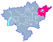
The Ińsko commune has an area of 151 km² and 3500 inhabitants. The western part of the municipality is located in the Iński Park Krajobrazowy Landscape Protection Park.
Neighboring communities are:
- Chociwel ( Freienwalde ) and Dobrzany ( Jacobshagen ) in the Powiat Stargardzki ,
- Drawsko Pomorskie ( Dramburg ) and Kalisz Pomorski ( Kallies ) in the Powiat Drawski ( Dramburg district ), and
- Węgorzyno ( Wangerin ) in the Powiat Łobeski ( Labes district ).
Community structure
Belong to Gmina Ińsko
- a city:
- Ińsko (Nörenberg)
- seven districts ( Schulzenämter ):
- other localities:
Landscape protection park
The Ińsko Protected Landscape Area (Iński Park Krajobrazowy), established in 1981, extends north and west of the city of Ińsko and has ten lakes, of which Lake Enzig (Jezioro Ińsko) is the largest. The source of the Ihna is five kilometers east of Ciemnik .
traffic
Streets
The Polish state road 151 runs through the Gmina Ińsko in a north-south direction and leads from Świdwin ( Schivelbein ) to Gorzów Wielkopolski ( Landsberg ad Warthe ). It connects the municipality with important roads:
- in the north: DK 20 Stargard ( Stargard in Pomerania ) - Gdynia ( Gdingen ) (former German Reichsstrasse 158 ), and
- in the south: DK 10 Lubieszyn ( Neu Linken ) on the German-Polish border - Płońsk ( Plhnen ) (former Reichsstraße 104 ).
rails
While a stretch of the Saatziger Kleinbahnen used to run through the current municipality, there is no longer a rail connection today.
literature
- Paul Schulz (ed.): The Saatzig district and the independent city of Stargard - A Pomeranian homeland book . Rautenberg, Leer 1984, ISBN 3-7921-0307-9 .
- Gustav Kratz : The cities of the province of Pomerania - an outline of their history, mostly according to documents . Berlin 1865, pp. 279-281 .
- Heinrich Berghaus : Land book of the Duchy of Pomerania and the Principality of Rügen . Part II, Volume 4, Anklam 1868, 382-410 .
- Johannes Hinz: Pomerania. Signpost through an unforgettable country . Bechtermünz, Augsburg 1996, ISBN 3-86047-181-3 .
Web links
- City website
- Nörenberg on the Saatzig home district website
- Information on city history; old views
- The town of Nörenberg in the former Saatzg district (Gunthard Stübs and Pomeranian Research Association, 2011)
Individual evidence
- ↑ a b population. Size and Structure by Territorial Division. As of June 30, 2019. Główny Urząd Statystyczny (GUS) (PDF files; 0.99 MiB), accessed December 24, 2019 .
- ↑ a b Meyer's Large Conversation Lexicon . 6th edition, Volume 14, Leipzig and Vienna 1908, p. 778.
- ↑ a b c d e f g h Gustav Kratz : The cities of the province of Pomerania - outline of their history, mostly according to documents . Berlin 1865, p. 280.
- ^ Heinrich Berghaus : Land book of the Duchy of Pomerania and the Principality of Rügen . Second part, fourth volume, Anklam 1868, pp. 386-388.
- ↑ a b The municipalities and manor districts of the province of Pomerania and their population. Edited and compiled by the Royal Statistical Bureau from the original materials of the general census of December 1, 1871. In: Königliches Statistisches Bureau (Hrsg.): The communities and manor districts of the Prussian state and their population. tape III , 1874, ZDB -ID 2059283-8 , p. 44 f . ( Digitized - No. 3).
- ↑ a b c d Michael Rademacher: German administrative history from the unification of the Reich in 1871 to the reunification in 1990. saatzig.html. (Online material for the dissertation, Osnabrück 2006).
- ^ The town of Nörenberg in the former Saatzig district in Pomerania (Gunthard Stübs and Pomeranian Research Association)
- ↑ Główny Urząd Statystyczny, "LUDNOŚĆ - STAN I STRUKTURA W PRZEKROJU TERYTORIALNYM", as of December 31, 2007 ( memento of the original from September 20, 2008 in the Internet Archive ) Info: The archive link was automatically inserted and not yet checked. Please check the original and archive link according to the instructions and then remove this notice.


