Jocotitlán (volcano)
| Jocotitlán | ||
|---|---|---|
|
The Xocotépetl volcano from Atlacomulco |
||
| height | 3900 m | |
| location | Northwest of the state of México | |
| Mountains | Neo-volcanic axis | |
| Coordinates | 19 ° 44 '25 " N , 99 ° 45' 31" W | |
|
|
||
| Type | Stratovolcano | |
| Last eruption | 1270 | |
Jocotitlan or Xocotépetl is a volcano in the Mexican state of México . With its 3900 m , it is a significant elevation in Mexico.
Physical aspects
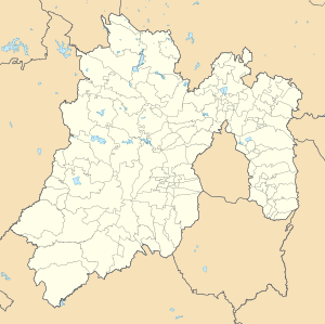
The Jocotitlán is located in the northwest of the state of Mexico between the municipalities of Jocotitlán and Atlacomulco and is part of the neo-volcanic axis in the Toluca basin . It is a stratovolcano that was created by lava flows and pyroclastic ejection. The remains of these eruptions can be seen in two open craters north of the summit, where tezontle and basalt , used locally as building material, are found.
In 1975, an area of 3701 hectares around Jocotitlán was designated as a nature reserve with the name "Isidro Fabela National Park" in honor of the scientist and diplomat Isidro Fabela (1882–1964) who was resident in the region . The main aim was to protect the volcano from deforestation and to prevent the construction of further radio antennas, several of which can already be found in various places on the volcano.
Like much of the mountainous areas of Mexico, the Xocotépetl is covered by a subtropical coniferous forest. It is a mixed forest with predominantly pine and holm oak . Various native mammals live in the forest, such as the coyote , the Central American catfish , the tlacuache and the gray fox .
Toponymy and cultural significance
The official and most common name the volcano bears is that of Jocotitlán, the city at the foot of the volcano. This term comes from Nahuatl xocotl , "bittersweet fruit" and -titlan , "place between": "place between bittersweet fruits". The alternative name Xocotépetl has a similar origin ( xocotl ; tepētl , "mountain": "mountain of bittersweet fruits"). Colloquially it is also known as "Cerro Viejo" or "Cerro de Joco".
Other localities in the region have their own names for the mountain. The Mazahuas called it Nguemore , "holy mountain". In the Otomí mythology, the volcano was also an ancient city and appears in some of its legends as a partner of the Nevado de Toluca . The Otomí called him Gumidi , "who sits on his head".
In pre-Columbian Mexico, the volcano was the place of worship of Otontecuhtli, the chief god of the Otomis, who was also known to the Nahua people as the god of fire with the name Xiuhteuctli. At 3670 meters above sea level there is a chapel dedicated to San Antonio. This is probably the highest chapel in the country.
Volcanic activity
Jocotitlán was previously considered an extinct volcano, but evidence of at least two eruptions in the last 10,000 years was discovered in the 1990s. Proof are the numerous so-called "volcanoes", a series of cinder cones that are located nearby. As a result, the Xocotépetl is currently classified as a potentially active volcano that could wreak havoc in the Toluca metropolitan area and Mexico City , two of the most densely populated metropolitan areas in the country, if it erupted .
Rockclimbing
The Xocotepetl can be easily climbed from Jocotitlán and La Providencia. There is also a winding dirt road with a length of 19 km and a difference in altitude of more than 1000 meters.
Individual evidence
- ↑ Global Volcanism Program - Jocotitlán :. Retrieved October 19, 2019 .

