John Harris Bridge
Coordinates: 40 ° 14 ′ 53 " N , 76 ° 52 ′ 40" W.
| John Harris Bridge | ||
|---|---|---|
| use |
|
|
| Crossing of | Susquehanna River | |
| place | Harrisburg and Lemoyne , Pennsylvania | |
| Entertained by | PennDOT | |
| construction | Girder bridge | |
| overall length | 970 m | |
| Longest span | 51.8 m | |
| start of building | 1957 | |
| opening | 1960 | |
| location | ||
|
|
||
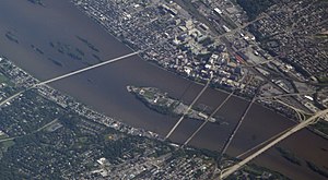
| Harrisburg with City Island on Susquehanna | ||
|
The bridges at the level of the river island from left to right: M. Harvey Taylor Memorial Bridge Walnut Street Bridge Market Street Bridge Cumberland Valley Railroad Bridge Philadelphia and Reading Railroad Bridge ( Dock Street Dam ) John Harris Bridge |
||
The John Harris Bridge , also South Bridge , is a seven-lane road bridge over the Susquehanna River between Harrisburg and Lemoyne in the state of Pennsylvania in the USA . It leads the Interstate Highway 83 and is with the George N. Wade Memorial Bridge located further upstream part of the Capital Beltway , a ring road around the metropolitan area of Harrisburg. The bridge is used by an average of 96,000 vehicles daily and is operated by the Pennsylvania Department of Transportation . The bridge is named after the founder and namesake of the city of Harrisburg John Harris, Sr. (1673-1748).
The one kilometer long girder bridge was built in the late 1950s as part of the expressway connection between Harrisburg and Baltimore , which became part of the newly emerging network of interstate highways . At the time of inauguration on January 22, 1960, it had four lanes and was expanded to six by 1982. The shoulder on the downstream side was then converted into another lane in 2015 towards Harrisburg, which becomes the exit onto Second Street at the end of the bridge .
Today's main bridge consists of two parallel girder bridges made of solid wall girders that rest on 18 river pillars and form 19 spans between 43.2 m and 51.8 m. This is followed by the access roads from a large number of other girder bridges. The original bridge had two 7.9 m wide carriageways for two lanes each . By 1982 the river pillars on the downstream side were extended, the second bridge girders installed in the same design and connected to the old ones. This resulted in two 15.9 m wide lanes, which are now used for three lanes to the south and four to the north.
Web links
- Nick Malawskey: Roadwork ahead: Rebuilding I-83 around Harrisburg means a decade or more of construction. PennLive, February 27, 2017.
Individual evidence
- ^ Harrisburg I-83 Capital Beltway. Pennsylvania Department of Transportation. Retrieved December 17, 2017.
- ↑ State Bridges Listing as of July 2017. Open Data PA, Commonwealth of Pennsylvania (Bridge Reference Number 14257). Retrieved December 15, 2017.
- ↑ Erik V. Fasick: Harrisburg and the Susquehanna River. Images of America, 2015, ISBN 978-1467122986 , pp. 15–32, here p. 31 f.
- ^ Teresa Boeckel: Second lane to Harrisburg to open soon at I-83 / Route 581 interchange, new bridge to be set. ( Memento of July 29, 2015 on the Internet Archive ) York Daily Record, May 27, 2015.
- ↑ a b M. H. Soto: Some Considerations in Widening and Rehabilitation of Bridges. Transportation Research Record 664, Transportation Research Board, St. Louis, Missouri, 1978.


