Küllstedter tunnel
| Küllstedter tunnel | ||
|---|---|---|
|
West portal
|
||
| traffic connection | Leinefelde – Treysa railway line | |
| place | Küllstedt | |
| length | 1530 m | |
| Number of tubes | 1 | |
| Largest coverage | 50 m | |
| construction | ||
| start of building | 1875 | |
| completion | 1878 | |
| business | ||
| release | 1880 | |
| closure | 1998 | |
| location | ||
|
|
||
| Coordinates | ||
| East portal | 51 ° 15 ′ 35 " N , 10 ° 17 ′ 26" E | |
| West portal | 51 ° 15 ′ 32 ″ N , 10 ° 16 ′ 7 ″ E | |
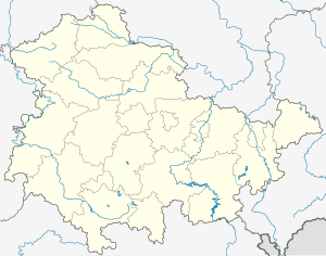
The Küllstedter Tunnel is a 1530 m long railway tunnel in the Thuringian district of Eichsfeld , which is located on the Leinefelde – Treysa railway line opened in 1880 , which was part of the so-called " Kanonenbahn " and has been closed since 1998. It is the second longest railway tunnel in Thuringia after the Brandleitetunnel and was also the second longest in the network of the Deutsche Reichsbahn .
The Küllstedter Tunnel (construction period: 1875/78) is located between Küllstedt and Effelder in an S-curve with a 974 meter long intermediate straight: Ostend 425 m long curve with a radius of 780 meters, west end with a 131 meter long curve with a radius of 400 meters. It has a continuous gradient of 1: 112 to the west. The mean altitude of the tunnel is around 384.5 meters above sea level . The tunnel lies in a stable mountain range with layers of the middle and upper shell limestone . The limestone is firm and durable, but within the tunnel changes in strength several times. In the pre-cuts where the rock enters, it is layered and partly badly weathered. The maximum overlap is 50 meters. The ridge passed through is mainly used for agriculture. In the overburden of the constantly running water leading carrots trench crossing the tunnel axis twice and favored occurred moisture penetration of the tunnel. During the work on the tunnel, measures had to be taken to drain off large amounts of water. This included the creation of a side tunnel and the filling of the dried tunnel with stones. In addition, further tunnels were driven along the abutments for better water drainage. The Küllstedter tunnel devoured 2,642,000 marks (22.00 marks for the portals), the highest construction costs of all tunnels in the Leinefelde – Treysa section.
The engraved year "1875" in the keystone of the western and "1879" in the eastern tunnel portal reminds of the construction time. The towers on the left and right on both portals are believed to be a sign of the art of the builders. The eastern tunnel portal can be reached from the bridge over the local connection road Büttstedt –Küllstedt after about 400 meters in a westerly direction. The state road L 1008 from Küllstedt to Struth crosses in the middle in a north-south direction.
The tunnel is part of the railway line from Lengenfeld unterm Stein to Küllstedt, which today can be traveled by handcar and bike along the Kanonenbahn cycle path .

