
Effelder
| coat of arms | Germany map | |
|---|---|---|
.png)
|
Coordinates: 51 ° 14 ′ N , 10 ° 15 ′ E |
|
| Basic data | ||
| State : | Thuringia | |
| County : | Eichsfeld | |
| Management Community : | Westerwald-Obereichsfeld | |
| Height : | 470 m above sea level NHN | |
| Area : | 10.94 km 2 | |
| Residents: | 1189 (Dec. 31, 2019) | |
| Population density : | 109 inhabitants per km 2 | |
| Postal code : | 37359 | |
| Area code : | 036075 | |
| License plate : | EIC, HIG, WBS | |
| Community key : | 16 0 61 027 | |
| LOCODE : | DE EFL | |
| Association administration address: | Neue Str. 16 37359 Küllstedt |
|
| Website : | ||
| Mayor : | Hans-Werner Lange | |
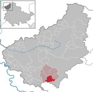
| Location of the municipality of Effelder in the Eichsfeld district | ||
  |
||


Effelder is a municipality in the Eichsfeld district in Thuringia . It belongs to the administrative community of Westerwald-Obereichsfeld .
geography
location
Effelder is located on a limestone plate in the Obereichsfeld south of the Westerwald ridge in the Eichsfeld-Hainich-Werra Valley Nature Park . The lowest point of the village is about 307 m above sea level in the Luttergrund west of the Klostermühle, the highest point is the top of the Rain, about 2 km west of the town center, at 516.7 m above sea level. Other mountain peaks in the area marker of Effelder are the 464.7 m high Uhlenstein, the 443.7 m high Große Iberg and the 416.0 m high Mühlberg. All three peaks are west of the village.
geology
The near-surface geological subsurface of Effelder is almost entirely formed by the rocks of the lower, middle and upper shell limestone. The lower shell limestone or wave limestone forms a step of about 100 to 150 m high on the western edge of the location marker. In the area of the middle Muschelkalk, which stands in the center of the village, another step, only about 30 m high, leads up to the Rain plateau formed by the thick limestone of the upper Muschelkalk . Both steps are clearly indented by the cuts of the Rottenbachtal and the Luttergrund in the west and the Huebental in the north. From the south, the Blankental encroaches on the plateau. While lower and upper Muschelkalk are made up of limestone layers of different thickness and permeable to water due to their vertical fissures, the middle Muschelkalk consists of water-retaining clays and limestone marls.
Waters
In the village, the Kellerborn, a southern tributary of the Lutter, has its source on Borngasse from a spring set in stone and hidden behind a locked door since 1976 .
history
Middle Ages until 1900
Effelder was first mentioned in 1215 as Effeldere (from Old High German affoltra , apple tree) in a document issued by Pope Innocent III. , mentioned, who took the Zella monastery under his protection and confirmed his possessions and rights, including in Effelder, whereby the Benedictine monastery at that time owned 40 Hufen , the Lutter and the monastery mill and the church and thus exercised the right of patronage over Effelder. The owners of the village at that time were the Counts of Gleichenstein . In 1280 Effelder was sold by the Counts for twelve marks of silver to the monastery for repurchase except for blood jurisdiction, which held local rule until the secularization in 1810 . In 1294, the jurisdiction over the neck fell to the Electorate of Mainz , as in that year the Archbishop of Mainz Gerhard II acquired the Eichsfeldgau and had it administered by the Bailiff von Gleichenstein. During the reorganization of Eichsfeld under the French, the Erfurt district had to pay a war tax of 460,000 thalers in 1806, of which Effelder alone had to pay 1175 rich thalers in cash and 928 thalers in the form of taxes in kind . At that time the village had just under 950 inhabitants and was part of the Kingdom of Westphalia from December 1, 1807 , which was also reflected in the fact that the place, together with Lengenfeld unterm Stein , Faulungen , Hildebrandshausen , Küllstedt and waxedt, belonged to the canton Großbartloff in the district Heiligenstadt was subordinated. Until 1815, the canton of Großbartloff was Maire Anton Grundmann. In the municipality of Effelder, when it was taken over by the French in 1808, the division of the rulers into two parts, usually with the manorial school and the monastery school, ended. The community then had only one head, also named Maire . The first with this title was the monastery school Adam Drößler, who was assisted by an adjunct and eight municipal councilors . The monastery court responsible for the communities of Effelder and Struth was dissolved, from then on royal courts were to exercise jurisdiction. During Napoleon's Russian campaign there were also some Effelder soldiers among the soldiers. After Napoleon's defeat in Russia in November 1813, Effelder housed around 700 to 800 Imperial Russian soldiers for a few days. The old baroque church, which was destroyed by fire (lightning strike) on January 26, 1890, was replaced in 1894 by a striking new building, the Eichsfeld Cathedral . In 1876 bracteates, i.e. hollow pennies made of silver from the Mühlhausen Imperial Mint from around 1215 were found (the so-called Effelder Fund).
- Data source: Mzfr.T.159 / 6 Effelder Fund Löbb.Nro.722
1900 until today
On December 27, 1909, the community assembly decided to connect the village to the local power grid, for which a plan of the route of the high-voltage lines was determined on July 29, 1910. Almost a year after the decision, the high-voltage lines, transformer stations and house systems were put into operation, so that on December 19, 1910, the place was finally equipped with electric light. Calculations showed that in 1912 there was an electric lamp for every fifth inhabitant. On November 9, 1911, Effelder was connected to a public water pipe, through which water was pumped from the Gläsner spring near Großbartloff into an elevated tank on the Rain, and from there it reached households.
Effelder was occupied by US soldiers on April 5, 1945 , recaptured on April 6 by a Wehrmacht scouting force and taken again by the US Army on April 7 in the course of the Battle of Struth . From the beginning of July the place became part of the Soviet Zone and from 1949 the GDR.
In 1966 the districts of Annaberg and Kloster Zella were formed.
During the GDR era , the residents of Effelder paid little attention to the banners, posters, writings and speeches that extolled the advantages of socialism over capitalism. This is confirmed by a report from a delegation of SED district party students from 1961, which came to the conclusion that “some of the residents of Effelder are not yet convinced of the victoriousness of socialism. One does not believe that we will be able to catch up with West Germany in economic terms in the foreseeable future, since the FRG is far ahead of us in the organization of production and the mechanical equipment of the factories ”. Around the same time, the restructuring of agriculture in the Worbis district was completed and the LPG Kellerborn was founded in Effelder , where 36 employees were still employed in 1989. In spite of economic and financial bottlenecks, building measures were carried out to create a school, gym, fire station, morgue, sports field, paving several streets and the sewer system. Often the measures took place with the help of the NAW .
coat of arms
The new creation of the town's coat of arms dates back to 1993 and contains a seal motif, which in turn dates back to 1951. The central motif of the coat of arms is the Church of St. Albanus, which is considered the landmark of the mountain community. The silver six-spoke wheel traces Effelder's centuries of affiliation with Kurmainz, while the apple refers to the place name. It can be etymologically derived from the Old High German apaldar (apple tree). Blazon : "In a red shield with a 16 gestückten silver board a gold single-tower church beseitet top right of a silver apple and top left of a silver sechsspeichigen wheel ( Wheel of Mainz )."
Population development
Development of the population (December 31) :
|
|
|
|
|
- Data source: Thuringian State Office for Statistics
politics
Municipal council
The town council of Effelder consists of 12 town council members.
- Free voter community : 12 seats
(As of: local elections on June 7, 2009)
mayor
The honorary mayor Hans-Werner Lange was re-elected on June 6, 2010.
Culture
Nickname
As evidence of coarse folk humor, neck names and nicknames that characterize each village developed centuries ago . Accordingly, the Affaller Ramssecke ("Effelder Rammsäcke", from "Ramschen", "gathering up") lived in the village .
Attractions

- The St. Alban Church, newly built in 1892, was the result of a community effort by the village. Brother Paschalis Gratze , who belongs to the Franciscan monastery in Hülfensberg and who created his masterpiece here, was commissioned as the master builder . The 56 meter high tower is a landmark and protrudes far above the area around the municipality of Effelder. The three-aisled neo-Gothic hall church, like the tower, is made of light-colored limestone from local quarries. The high, well-proportioned tracery windows made of sandstone and painted glass are based on the traditional construction of the 14th century. Inside, the majolica- style depictions of the Stations of the Cross by the Munich artist Georg Kemper, created between 1924 and 1928, catch the eye. The church is often referred to as "Eichsfeld Cathedral" due to its size and overall impression.
- Another way of the cross leads from Eichsfeld Cathedral through the Effeldersche Flur to the St. Vitus Chapel in the north.
- The so-called weather cross, lined with a group of linden trees, is located on the northeastern edge of the village. A procession takes place there every year.
Coin finds
In the 19th and 20th centuries, various coins were found that are dated to the 13th to 14th and 17th to 18th centuries. The first were found during the demolition of the old churchyard wall in 1876, they were located between two exposed human skeletons. Out of a total of 210 pieces, most had a diameter of 28 to 29 millimeters; the coin images mostly depicted riders. On February 18, 1876, the city council of Mühlhausen bought the coins for 16 thalers. Some of the coins are in the Mühlhausen local history museum. The second coin was found in 1946 during renovation work in the Luttermühle; around 200 coins were found, the minting of which dates from between 1670 and 1720. According to tradition, it was the cash of a beggar who hid his money there after he was admitted to the Luttermühle. The coins are in private hands.
societies

Effelder offers a variety of clubs. The St. Hubertus rifle club was founded in 1874, and the Freiwillige Feuerwehr Effelder eV was founded in 1927. More recent are the oldtimer and tractor club, which has organized a “tractor meeting” every year since 2007, and the Germania Effelder sports club. In 1998 the Effelder carnival club was founded.
Events
- Tug meeting in August
- Boys fair on the 3rd weekend in October: Highlights are the fair church service in St. Alban and the dance of the fair couples on the fairground on Sunday, the shaving of the "firstlings" on the fairground on Monday and that Mutton meal on the fair Tuesday.
literature
- Ewald Kühler: History of the Eichsfelddorf Effelder . Mecke, Duderstadt 1999, ISBN 978-3-932752-35-3 .
Web links
Individual evidence
- ^ Population of the municipalities from the Thuringian State Office for Statistics ( help on this ).
- ↑ Info from westerwald-obereichsfeld.eu
- ↑ Local elections in Thuringia on June 7th, 2009. Elections for community and city council members. Preliminary results. (PDF; 1.9 MB) The State Returning Officer, accessed on March 10, 2010 .
- ↑ Local elections in Thuringia on June 6, 2010. Elections for community and city council members. Preliminary results. The regional returning officer, accessed on June 6, 2010 .
- ↑ Rolf Aulepp nicknames of the places and their inhabitants in the district of Mühlhausen In: Eichsfelder Heimathefte, Heft 1, Heiligenstadt 1987, pp. 78–83.
- ^ "Eichsfeld Cathedral, Effelder" . In: Sparkassen-Kulturstiftung Hessen-Thüringen (Hrsg.): Cultural discoveries. Eichsfeld district, Kyffhäuserkreis, Nordhausen district, Unstrut-Hainich district . tape 1 (Thuringia). Schnell & Steiner, Regensburg 2009, ISBN 978-3-7954-2249-3 , pp. 234-237 .
At the Ohmberg | Arenshausen | Asbach-Sickenberg | Berlingerode | Birkenfelde | Bodenrode-Westhausen | Bornhagen | Brehme | Width worbis | Buhla | Burgwalde | Büttstedt | Dieterode | Dietzenrode / Vatterode | Dingelstädt | Ecklingerode | Effelder | Eichstruth | Ferna | Freienhagen | Fretterode | Geisleden | Geismar | Gerbershausen | Gernrode | Glasehausen | Großbartloff | Haynrode | Heilbad Heiligenstadt | Heuthen | Hohengandern | High cross | Kella | Kirchgandern | Kirchworbis | Krombach | Küllstedt | Leinefelde-Worbis | Lenterode | Lindewerra | Lutter | Mackenrode | Marth | Lower Orschel | Pfaffschwende | Reinholterode | Rohrberg | Röhrig | Rustenfelde | Schachtebich | Schimberg | Schönhagen | Schwobfeld | Sickerode | Sunstone | Steinbach | Steinheuterode | Keyings | Services | Thalwend | Uder | Volkerode | Waxed | Wahlhausen | Blowing | Wiesenfeld | Wingerode | Wüstheuterode