
Performance
| coat of arms | Germany map | |
|---|---|---|

|
Coordinates: 51 ° 28 ' N , 10 ° 16' E |
|
| Basic data | ||
| State : | Thuringia | |
| County : | Eichsfeld | |
| Management Community : | Lindenberg / Eichsfeld | |
| Height : | 200 m above sea level NHN | |
| Area : | 26.15 km 2 | |
| Residents: | 2546 (Dec. 31, 2019) | |
| Population density : | 97 inhabitants per km 2 | |
| Postal code : | 37339 | |
| Area code : | 036071 | |
| License plate : | EIC, HIG, WBS | |
| Community key : | 16 0 61 114 | |
| LOCODE : | DE TSG | |
| Community structure: | 3 districts | |
| Address of the municipal administration: |
Hauptstrasse 17 37339 Teistungen |
|
| Website : | ||
| Mayor : | Christoph Krukenberg (independent) | |
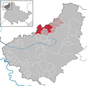
| Location of the municipality of Teistungen in the Eichsfeld district | ||
  |
||

Teistungen is a municipality in the Eichsfeld district in Thuringia . It is the seat of the administrative association Lindenberg / Eichsfeld . Since 1997 the place has been a state-approved resort of the Free State of Thuringia .
geography
Teistungen is located in the northwest of the Free State of Thuringia, directly on the state border with Lower Saxony . The Lower Saxony city of Duderstadt is about five km away.
Waters
The hollow , the oak and the basic cell flow through Teistungen .
The hollow crosses the place from southeast to northwest and divides the community in two halves. This body of water is also known for its wealth of trout.
The oak, sometimes also Eichbach , crosses the place from southwest to north and flows into the hollow at the northern development boundary.
The basic cell flows from the east into the village and flows into the hollow.
Community structure
The districts of Böseckendorf with Bleckenrode and Neuendorf belong to Teistungen .
history
Teistungen was first mentioned in a document in 1090. The story Teistungens was closely related to the 1260 as a daughter house of the Monastery Beuren founded monastery Teistungenburg connected. The monastery buildings were demolished in 1975.

In 1283 the Knights von Hagen bought goods in Teistungen. That is why there were two fortified mansions belonging to the von Westernhagen family . There was the upper and lower courtyard, each with a residential tower. Fortifications no longer exist. The Oberhof was bought back by the von Westernhagen family after German reunification .
The sovereign was Kurmainz until 1802 . From 1802 to 1807 the place was Prussian and then came to the Kingdom of Westphalia , from 1815 to 1945 it was part of the Prussian province of Saxony .
20th century
During the Second World War , more than 60 men and women from Poland and the Ukraine had to do forced labor on farms and on the Baroness von der Borardt's estate .
1945 to 1949 the place was part of the Soviet occupation zone and from 1949 part of the GDR . From 1961 until the turnaround and reunification in 1989/1990, Teistungen was affected by the closure of the nearby inner-German border. The border crossing point Worbis / Duderstadt on the F 247 or B 247 between Duderstadt (Lower Saxony) and Worbis was also known as the "Teistungen border crossing". On November 10, 1989, at 12:35 a.m., the barrier was opened to the west.
Since 1990 the place belongs to the re-established state of Thuringia.
Böseckendorf
The place was first mentioned in 1250 in a deed of donation issued by Ulrich von Regenstein .
Neuendorf
Neuendorf was first mentioned in 1274 as "villa nova". From 1512 to the middle of the 16th century Neuendorf was a desert.
Both former communities were incorporated into the Teistungen community on April 1, 1999.
Population development
Development of the population (December 31) :
|
|
|
|
- Data source: Thuringian State Office for Statistics
religion
75% of the residents are Catholic, 7% Protestant. The Catholics are assigned to the parish of St. Andreas Teistungen in the deanery of Leinefelde-Worbis of the Diocese of Erfurt , which also includes the parishes of St. Nikolaus in Böseckendorf, St. Nikolaus in Neuendorf, St. Dionysius in Hundeshagen, St. Stephanus in Berlingerode and St. John the Baptist in Ferna. The Catholic parish of St. Andreas in Teistungen was re-established on July 1, 2012. The area of the parish includes the places Berlingerode, Bleckenrode, Böseckendorf, Ferna, Hundeshagen, Neuendorf, Tastungen and Teistungen.
The Lutherans belong to the parish and rectory Tastungen in the Evangelical Church District Mühlhausen of the Evangelical Church in Central Germany ; Protestant services are held every two weeks in a church hall in a former rectory in Teistungen.
politics
Municipal council
The parish council of Teistungen is composed of 14 parish council members:
Status: ( Local election on May 25, 2014 )
mayor
On February 10, 2019, Christoph Krukenberg was elected honorary mayor with 59% of the vote.
Partnerships
A local partnership exists with Dobšiná in Slovakia .
Culture and sights
Museums
Directly on the former inner-German border is the Grenzlandmuseum Eichsfeld , which opened in 1995 and has since been expanded several times . It provides information on the history of the inner-German border and its impact on the population in the border area.

Buildings

The modern Catholic parish church of St. Andreas was built in 1933–1934 by the Düsseldorf architect Thiethmann on the site of a previous building. The baroque high altar comes from the nearby former Teistungenburg monastery .
Other destinations
As part of a renaturation project, a hiking trail was laid out around the Glockengraben reservoir and trees and bushes were planted. The lake was populated with carp, pike, eel, pikeperch, tench and perch. The water is suitable for pike fishing in the autumn months.
Sports facility Am Klosterholz
A new sports facility for FC Wacker 1914 Teistungen eV is located in the adjacent Am Klosterholz forest . The facility includes an artificial turf and grass pitch and a sports house. Equipment is available for volleyball and basketball. Since the facility was completed in 2003, a number of well-known football teams have been in the training camp there, e. B. Eintracht Frankfurt , Fortuna Düsseldorf , Hansa Rostock , 1. FSV Mainz 05 , VfL Bochum , 1. FC Magdeburg , VfL Wolfsburg , BSG Chemie Leipzig , 1. FC Lokomotive Leipzig , SC Paderborn 07 , Arminia Bielefeld and Dynamo Dresden .
Sports club FC Wacker 1914 Teistungen eV
The club became the district cup winner of the Eichsfeld district in 2014.
In May / June 2015, the first team of the club managed the feat of becoming champions of the Eichsfeld / Unstrut-Hainich regional league, defending the Eichsfeld district cup and the regional cup (against the winner of the district cup from the Unstrut-Hainich district : Hüpstedt).
In the 2015/2016 season, the team, as a newcomer to the Thuringian state class, season 2, was sovereign - with a 13 point lead over the pursuers - and thus promoted to the top division of the Thuringian Football Association (Verbandsliga, also known colloquially as the "Thuringian League").
traffic
Street
The B 247 and the state roads 1009 and 2016 run through Teistungen .
Bicycle traffic
Teistungen is connected to the international Iron Curtain Trail , which runs along the former Iron Curtain from Norway to the Black Sea.
rail
Teistungen is located on the now decommissioned Lower Field Railway from Wulften via Duderstadt, Teistungen and Worbis to Leinefelde . The remainder of the Leinefelde – Teistungen line left by the division of Germany was closed in 2001. The last passenger train ran from Teistungen to Leinefelde on June 27, 2001.
Sons and daughters of the church
- Louis von Rothmaler (1814–1884), Prussian infantry general
- Julius von Westernhagen (1828–1905), Prussian major general
- Johannes-Leo Hoffmann (1941–1972), fatality on the inner-German border
literature
- Heinz Kowallik: 800 years of Teistungen parish 1189-1989 . 1989, p. 8 .
Individual evidence
- ^ Population of the municipalities from the Thuringian State Office for Statistics ( help on this ).
- ^ Michael Köhler: Thuringian castles and fortified prehistoric and prehistoric living spaces , Jenzig-Verlag, 2001, ISBN 3-910141-43-9 , p. 245
- ↑ Thuringian Association of the Persecuted of the Nazi Regime - Bund der Antifaschisten und Studienkreis deutscher Resistance 1933–1945 (Ed.): Heimatgeschichtlicher Wegweiser to Places of Resistance and Persecution 1933–1945 , Series: Heimatgeschichtliche Wegweiser, Volume 8 Thüringen, Erfurt 2003, ISBN 3 -88864-343-0 , p. 44.
- ↑ StBA: Changes in the municipalities in Germany, see 1999
- ↑ 2011 census
- ^ 2014 municipal council elections in Thuringia, Thuringian State Office for Statistics
- ↑ Mayoral elections in Thuringia, Thuringian State Office for Statistics
- ↑ [1]
- ↑ http ://www. Grenzlandmuseum.de/
- ↑ Anja Sieges, Peter Wurschi: The former border as a biotope From the death strip to the green bridge. In: Der Tagesspiegel. October 1, 2016, accessed April 14, 2017 .
Web links
- Literature by and about Teistungen in the catalog of the German National Library
At the Ohmberg | Arenshausen | Asbach-Sickenberg | Berlingerode | Birkenfelde | Bodenrode-Westhausen | Bornhagen | Brehme | Width worbis | Buhla | Burgwalde | Büttstedt | Dieterode | Dietzenrode / Vatterode | Dingelstädt | Ecklingerode | Effelder | Eichstruth | Ferna | Freienhagen | Fretterode | Geisleden | Geismar | Gerbershausen | Gernrode | Glasehausen | Großbartloff | Haynrode | Heilbad Heiligenstadt | Heuthen | Hohengandern | High cross | Kella | Kirchgandern | Kirchworbis | Krombach | Küllstedt | Leinefelde-Worbis | Lenterode | Lindewerra | Lutter | Mackenrode | Marth | Lower Orschel | Pfaffschwende | Reinholterode | Rohrberg | Röhrig | Rustenfelde | Schachtebich | Schimberg | Schönhagen | Schwobfeld | Sickerode | Sunstone | Steinbach | Steinheuterode | Keyings | Services | Thalwend | Uder | Volkerode | Waxed | Wahlhausen | Blowing | Wiesenfeld | Wingerode | Wüstheuterode