
Administrative community Lindenberg / Eichsfeld
| coat of arms | Germany map | |
|---|---|---|

|
Coordinates: 51 ° 28 ' N , 10 ° 16' E |
|
| Basic data | ||
| Existing period: | 1991– | |
| State : | Thuringia | |
| County : | Eichsfeld | |
| Area : | 68.93 km 2 | |
| Residents: | 6754 (Dec. 31, 2019) | |
| Population density : | 98 inhabitants per km 2 | |
| License plate : | EIC, HIG, WBS | |
| Association key : | 16 0 61 5001 | |
| Association structure: | 7 municipalities | |
| Association administration address : |
Main street 17 37339 Teistungen |
|
| Website : | ||
| Chairman : | Thomas Raabe | |
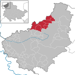
| Location of the Lindenberg / Eichsfeld administrative community in the Eichsfeld district | ||
  |
||

In the administrative community of Lindenberg / Eichsfeld from the Thuringian district of Eichsfeld , seven sub- area municipalities have come together to carry out their administrative business. The administrative community was named after the 286 m high Lindenberg and the Eichsfeld .
The administrative community is based in Teistungen .
Geographical location

The management community is located between the ridges of the Ohm Hills (the Trogberg : 503 m) in the southeast and the tens of the mountain (with the Rotenberg : 407 m) in the southwest and the low-Saxon -thüringischen border in the north. The Hahle with its smaller tributaries ( Brehme , Nisse , Eichbach ) drain the landscape to the north.
In terms of traffic, the administrative community is connected via the federal road 247 , and the federal highway 38 runs not far to the south .
The municipalities
The municipalities and their number of inhabitants in brackets (as of December 31, 2019):
- Berlingerode (1222)
- Brehme (1102)
- Ecklingerode (721)
- Ferna (563)
- Keys (221)
- Teistungen (2546)
- Billowing (379)
history
The administrative community was founded on April 25, 1991. The Böseckendorf and Neuendorf communities were dissolved on April 1, 1999 with the incorporation into Teistungen. On March 15, 2004, the municipality Ferna from the administrative community Am Ohmgebirge was added after the three other municipalities of the administrative community had merged with the city of Leinefelde to form the new city of Leinefelde-Worbis . Hundeshagen left the administrative community on July 6, 2018 as part of the Thuringia regional reform in 2018 and 2019 and was incorporated into Leinefelde-Worbis.
Population development
Development of the population:
|
|
|
|
|
Data source: from 1994 Thuringian State Office for Statistics - values from December 31st
Individual evidence
- ^ Population of the municipalities from the Thuringian State Office for Statistics ( help on this ).
- ^ Population of the municipalities from the Thuringian State Office for Statistics ( help on this ).
existing: Eichsfeld-Wipperaue | Ershausen / Geismar | Hanstein-Rusteberg | Leinetal | Lindenberg / Eichsfeld | Uder | Westerwald-Obereichsfeld
former: Am Ohmgebirge | Dingelstädt | Eichsfelder Kessel | Eichsfeld-Südharz | Geismar | Upper Bode | Südichsfeld