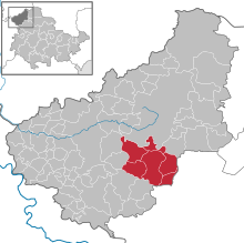
Administrative community Dingelstädt
| coat of arms | Germany map | |
|---|---|---|
 Help on coat of arms |
Coordinates: 51 ° 19 ′ N , 10 ° 19 ′ E |
|
| Basic data (as of 2018) | ||
| Existing period: | 1991-2018 | |
| State : | Thuringia | |
| County : | Eichsfeld | |
| Area : | 64.92 km 2 | |
| Residents: | 7492 (Dec. 31, 2018) | |
| Population density : | 115 inhabitants per km 2 | |
| License plate : | EIC, HIG, WBS | |
| Association key : | 16 0 61 5003 | |
| Association structure: | 6 municipalities | |
| Association administration address : |
Geschwister-Scholl-Str. 26/28 37351 Dingelstädt |
|
In the administrative community Dingelstädt from the Thuringian district of Eichsfeld , the city of Dingelstädt and five municipalities had come together to handle their administrative business.
The seat of the administrative community was Dingelstädt . The last chairman was Andreas Karl Fernkorn.
The administrative community dissolved as part of the regional reform on December 31, 2018. The rural community of Dingelstädt was created .
The municipalities
The following are the municipalities and their number of inhabitants in brackets (as of December 31, 2017):
- Dingelstädt , City (4349)
- Helmsdorf (501)
- Kallmerode (601)
- Kefferhausen (723)
- Kreuzebra (716)
- Silberhausen (612)
history
The administrative community was founded on April 3, 1991. As part of the Thuringia regional reform in 2018 and 2019 , the administrative community was dissolved on December 31, 2018. Kallmerode was incorporated into Leinefelde-Worbis . The other member communities merged to form the rural community of Dingelstädt.
Population development
Development of the population:
|
|
|
|
Data source: from 1994 Thuringian State Office for Statistics - values from December 31st
Individual evidence
- ↑ Thuringian Law and Ordinance Gazette No. 14/2018 , accessed on May 20, 2019

