
Schachtebich
| coat of arms | Germany map | |
|---|---|---|

|
Coordinates: 51 ° 24 ' N , 10 ° 3' E |
|
| Basic data | ||
| State : | Thuringia | |
| County : | Eichsfeld | |
| Management Community : | Hanstein-Rusteberg | |
| Height : | 280 m above sea level NHN | |
| Area : | 3.81 km 2 | |
| Residents: | 238 (Dec. 31, 2019) | |
| Population density : | 62 inhabitants per km 2 | |
| Postal code : | 37318 | |
| Area code : | 036083 | |
| License plate : | EIC, HIG, WBS | |
| Community key : | 16 0 61 083 | |
| Association administration address: | Steingraben 49 37318 Hohengandern |
|
| Website : | ||
| Mayor : | Johannes Bitter | |
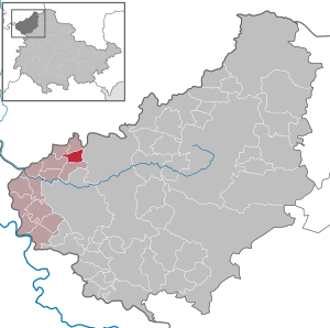
| Location of the community of Schachtebich in the Eichsfeld district | ||
  |
||

Schachtebich is a municipality in the Hanstein-Rusteberg administrative community in the Eichsfeld district of Thuringia .
location

Schachtebich is located about six kilometers northwest of Heilbad Heiligenstadt in the hilly landscape of the middle Eichsfeld ( the heads : 325.6 m). Neighboring communities are Freienhagen in the north, Mengelrode in the east, Burgwalde in the south and Rohrberg in the west. The federal motorway 38 runs immediately to the south with a junction. In the village lies the headwaters of the Schwobach , which flows into the Leine in Schönau .
- Goose pond
The municipality part Gänseteich , which is directly adjacent to the northern edge of the village, with the deserted Lentershagen area also belongs to the district .
history
The first documentary mention of it comes from the year 1201. In 1209 Schachtebich is mentioned as a parish branch of Rohrberg. The place belonged to Kurmainz until the secularization in 1802 . From 1802 to 1807 the place became Prussian and then became part of the Kingdom of Westphalia . From 1815 to 1945 it was part of the Prussian province of Saxony .
Around 1840 the Prussian locations of the Eichsfeld were recorded statistically. Schachtebich belonged to the Hahnstein Patrimonial Court Wahlhausen. There were 38 houses, 35 barns and stables, three parish houses, the church, the school and a mill in the village. 316 Catholic and four Protestant residents lived in the village. 39 boys and 52 girls attended the school and were taught by a village school teacher. Trades and trades are mentioned in the place: two tailors, two shoemakers, a blacksmith, a bricklayer, three musicians, two innkeepers, a butcher, a miller. There were also eight looms in operation in the village. The village corridor comprised 697 acres , of which the agricultural area comprised 550 acres of arable land, 31 acres of garden land, and eleven acres of meadows. Furthermore, 62 acres of private and community forest and 36 acres of fallow land were named. The yield of the fields was estimated as mediocre. The total livestock was 51 horses, 51 cattle, 141 sheep, 23 goats and 29 pigs.
In the years 1945 to 1949 the place came to the Soviet occupation zone and from 1949 was part of the GDR . From 1961 until the turnaround and reunification in 1989/1990, Schachtebich was affected by the closure of the nearby inner-German border. The sawmill on the road to Burgwalde had to be abandoned. It was demolished around 1980 after the house had already become uninhabitable due to fire damage in 1963.
Since 1990 the place belongs to the re-established state of Thuringia.

Population development
Development of the population (December 31) :
|
|
|
|
|
- Data source: Thuringian State Office for Statistics
politics
Municipal council
The community council of Schachtebich consists of six community council members.
- Election proposal FFw: 5 seats
- Proposal for popular solidarity: 1 seat
(As of: local elections on June 7, 2009)
Local election 2014:
- FFW e. V .: 4 seats
- Popular solidarity: 2 seats
mayor
The honorary mayor Johannes Bitter (FFw) was re-elected on June 6, 2010.
Attractions
The branch church of St. Magnus from 1735 is located in the village .
literature
- Municipal administration (ed.): Commemorative publication 800 years of the municipality of Schachtebich. 1201 to 2001 . Friedland / Reiffenhausen 2001.
Individual evidence
- ^ Population of the municipalities from the Thuringian State Office for Statistics ( help on this ).
- ↑ Dr. Erhard Müller: The place names of the district of Heiligenstadt. Heilbad Heiligenstadt 1989, page 40
- ↑ Carl August Noback : Detailed geographical-statistical-topographical description of the administrative district of Erfurt . Erfurt 1841, p. 167 .
- ↑ Volker Große, Klaus Herzberg: Mills in the Obereichsfeld . In: Maik Pinkert (Ed.): A compendium . Eichsfeld-Verlag, Heiligenstadt 2008, ISBN 978-3-935782-13-5 , p. 298 .
- ↑ Local elections in Thuringia on June 7th, 2009. Elections for community and city council members. Preliminary results. (PDF; 1.9 MB) The State Returning Officer, accessed on March 7, 2010 .
- ↑ http://wahlen.thueringen.de/datenbank/wahl1/wahl.asp?wahlart=GW&wjahr=2014&angeboteErg=GEM&auswert=1&wknr=061&gemnr=61083&terrKrs=&gemteil=000&buchstabe=&Langname=&wahlvorschlag=&sort=&druck=H&XL-S=& number 2 & Non_existing = & x_vollbildDatteil = & optik = & aktuell = & ShowLand = & ShowWK = & ShowPart =
- ↑ Local elections in Thuringia on June 6, 2010. Elections for community and city council members. Preliminary results. The regional returning officer, accessed on June 6, 2010 .
- ↑ Erika Dittrich: The Catholic village churches of Eichsfeld in the Electoral Mainz period (1670-1802) . Ed .: Association f. Eichsfeldische Heimatkunde e. V., Association “Goldene Mark” Untereichsfeld e. V. Mecke Druck, Duderstadt 2001, ISBN 978-3-932752-40-7 .
Web links
At the Ohmberg | Arenshausen | Asbach-Sickenberg | Berlingerode | Birkenfelde | Bodenrode-Westhausen | Bornhagen | Brehme | Width worbis | Buhla | Burgwalde | Büttstedt | Dieterode | Dietzenrode / Vatterode | Dingelstädt | Ecklingerode | Effelder | Eichstruth | Ferna | Freienhagen | Fretterode | Geisleden | Geismar | Gerbershausen | Gernrode | Glasehausen | Großbartloff | Haynrode | Heilbad Heiligenstadt | Heuthen | Hohengandern | High cross | Kella | Kirchgandern | Kirchworbis | Krombach | Küllstedt | Leinefelde-Worbis | Lenterode | Lindewerra | Lutter | Mackenrode | Marth | Lower Orschel | Pfaffschwende | Reinholterode | Rohrberg | Röhrig | Rustenfelde | Schachtebich | Schimberg | Schönhagen | Schwobfeld | Sickerode | Sunstone | Steinbach | Steinheuterode | Keyings | Services | Thalwend | Uder | Volkerode | Waxed | Wahlhausen | Blowing | Wiesenfeld | Wingerode | Wüstheuterode