
Tubular
| coat of arms | Germany map | |
|---|---|---|

|
Coordinates: 51 ° 20 ' N , 10 ° 3' E |
|
| Basic data | ||
| State : | Thuringia | |
| County : | Eichsfeld | |
| Management Community : | Uder | |
| Height : | 350 m above sea level NHN | |
| Area : | 2.8 km 2 | |
| Residents: | 235 (Dec. 31, 2019) | |
| Population density : | 84 inhabitants per km 2 | |
| Postal code : | 37318 | |
| Area code : | 036087 | |
| License plate : | EIC, HIG, WBS | |
| Community key : | 16 0 61 077 | |
| Association administration address: | Settlement 14 37318 Uder |
|
| Website : | ||
| Mayor : | Helmut Vogler | |
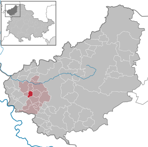
| Location of the community Röhrig in the district of Eichsfeld | ||
  |
||


Röhrig is a municipality in the Uder administrative community in the Thuringian district of Eichsfeld .
geography
The place is in a lowland and is surrounded by the Erpelsberg in the south (432 m) and the Röhrigsberg (485 m) in the north.
history
Röhrig is first mentioned in 1536 as "Roorich". The name is derived from the Low German word "Röhrig" for reed . The place belonged to Kurmainz until the secularization in 1802 and was subject to the jurisdiction of the von Hanstein family . From 1802 to 1807 the place became Prussian and then became part of the Kingdom of Westphalia . From 1815 to 1945 it was part of the Prussian province of Saxony . 1945 to 1949 the place came under the Soviet occupation zone and was part of the GDR from 1949 . From 1961 until the turnaround and reunification in 1989/1990, Röhrig was affected by the closure of the nearby inner-German border. Between 1974 and 1990 Röhrig was part of the municipality of Lenterode . Since 1990 Röhrig has been an independent municipality again and belongs to the re-established state of Thuringia.
Population development
Development of the population (December 31) :
|
|
|
|
- Data sources: Michael Rademacher: German administrative history from the unification of the empire in 1871 to the reunification in 1990. (Online material for the dissertation, Osnabrück 2006). and from 1994 Thuringian State Office for Statistics
politics
Municipal council
The community council of Röhrig consists of six community council members.
- Proposal for election Sportgemeinschaft Röhrig eV / CDU : 6 seats
(As of: local elections on June 7, 2009)
Local election 2014:
- Sportgemeinschaft Röhrig e. V .: 6 seats
mayor
The honorary mayor Helmut Vogler was elected on June 6, 2010.
Culture and sights
- Church of St. Elisabeth from 1800 with the sculpture "Our Lord in Misery", a Pietà and a statue of St. Elisabeth from the late Gothic period. It is also the only Elisabeth church in Eichsfeld.
Individual evidence
- ^ Population of the municipalities from the Thuringian State Office for Statistics ( help on this ).
- ↑ Local elections in Thuringia on June 7th, 2009. Elections for community and city council members. Preliminary results. (PDF; 1.9 MB) The State Returning Officer, accessed on March 10, 2010 .
- ↑ http://wahlen.thueringen.de/datenbank/wahl1/wahl.asp?wahlart=GW&wjahr=2014&habenErg=GEM&wknr=061&gemnr=61077
- ↑ Local elections in Thuringia on June 6, 2010. Elections for community and city council members. Preliminary results. The regional returning officer, accessed on June 6, 2010 .
Web links
At the Ohmberg | Arenshausen | Asbach-Sickenberg | Berlingerode | Birkenfelde | Bodenrode-Westhausen | Bornhagen | Brehme | Width worbis | Buhla | Burgwalde | Büttstedt | Dieterode | Dietzenrode / Vatterode | Dingelstädt | Ecklingerode | Effelder | Eichstruth | Ferna | Freienhagen | Fretterode | Geisleden | Geismar | Gerbershausen | Gernrode | Glasehausen | Großbartloff | Haynrode | Heilbad Heiligenstadt | Heuthen | Hohengandern | High cross | Kella | Kirchgandern | Kirchworbis | Krombach | Küllstedt | Leinefelde-Worbis | Lenterode | Lindewerra | Lutter | Mackenrode | Marth | Lower Orschel | Pfaffschwende | Reinholterode | Rohrberg | Röhrig | Rustenfelde | Schachtebich | Schimberg | Schönhagen | Schwobfeld | Sickerode | Sunstone | Steinbach | Steinheuterode | Keyings | Services | Thalwend | Uder | Volkerode | Waxed | Wahlhausen | Blowing | Wiesenfeld | Wingerode | Wüstheuterode