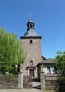
Freienhagen (Eichsfeld)
| coat of arms | Germany map | |
|---|---|---|

|
Coordinates: 51 ° 25 ' N , 10 ° 3' E |
|
| Basic data | ||
| State : | Thuringia | |
| County : | Eichsfeld | |
| Management Community : | Hanstein-Rusteberg | |
| Height : | 305 m above sea level NHN | |
| Area : | 4.11 km 2 | |
| Residents: | 285 (Dec. 31, 2019) | |
| Population density : | 69 inhabitants per km 2 | |
| Postal code : | 37318 | |
| Area code : | 036083 | |
| License plate : | EIC, HIG, WBS | |
| Community key : | 16 0 61 032 | |
| Association administration address: | Steingraben 49 37318 Hohengandern |
|
| Website : | ||
| Mayor : | Markus Kaspari ( CDU ) | |
| Location of the community of Freienhagen in the Eichsfeld district | ||
Freienhagen is a municipality in the Eichsfeld district in Thuringia . It belongs to the Hanstein-Rusteberg administrative community .
location
Freienhagen is located about six kilometers northwest of Heilbad Heiligenstadt on the red sandstone plateau of the middle Eichsfeld . Neighboring communities are Streitholz in the east, Schachtebich in the south, Rohrberg in the west and the Lower Saxony Gleichen with the village of Ischenrode in the northwest. The highest elevation with 352.6 m is to the east of the village, the district is mainly used for agriculture. The federal motorway 38 runs immediately to the south with a junction.
history
Freienhagen was first mentioned in 1304. Up to the Reichsdeputationshauptschluss 1802, Freienhagen belonged to Kurmainz and from 1815 as part of the district of Heiligenstadt until 1945 to the Prussian province of Saxony . 1945 to 1949 the place was in the Soviet occupation zone and was part of the GDR from 1949 . Until the fall of the Wall and reunification in 1989/1990, the place was close to the inner-German border.
There is a large boulder near Freienhagen. It is called the cuckoo stone or Boniface stone. Boniface is said to have baptized the pagans there in the 8th century. The surface of the stone is inclined in the shape of a desk and has well-shaped indentations.
Population development
Development of the population (December 31) :
|
|
|
|
|
- Data source: Thuringian State Office for Statistics
politics
Municipal council
The local council of Freienhagen consists of six council members.
|
Allocation of seats by the municipal council in 2014
A total of 6 seats
|
|||||||||||||||||||
| Parties and constituencies d | 2019 | 2014 | 2009 | 2004 | 1999 | 1994 | |||||||||||||
|---|---|---|---|---|---|---|---|---|---|---|---|---|---|---|---|---|---|---|---|
| Share a | Seats | Share a | Seats | Share a | Seats | Share a | Seats | Share a | Seats | Share a | Seats | ||||||||
| Christian Democratic Union of Germany | CDU | 70.2 | 6th | 88.3 | 6th | 88.4 | 6th | 88.9 | 6th | 62.3 | 6th | 100.0 | 6th | ||||||
| percentage of invalid votes | 8.9 | 2.9 | 3.1 | 11.7 | 2.8 | 6.5 | |||||||||||||
| Total seats | 6th | 6th | 6th | 6th | 6th | 6th | |||||||||||||
| voter turnout | 80.6% | 67.4% | 58.5% | 61.5% | 78.3% | 87.6% | |||||||||||||
|
a percentage of the valid votes cast
d Difference to 100%: other
|
|||||||||||||||||||
mayor
The honorary mayor of Freienhagen, Markus Kaspari (CDU) was re-elected with 53.2 percent in the local elections in Thuringia 2019 .
coat of arms
Blazon : "In red a shortened, curved, silver tip, in front a silver bell with a black passion cross, behind an arched silver bottle, in the tip a red six-spoke wheel."
Attractions
- Catholic Church of St. John the Baptist
- Town center with half-timbered houses
- Anger with a wayside shrine
literature
- Wilhelm Weidemann: 600 years of Freienhagen. Anniversary font . Freienhagen 2007, p. 68 .
Individual evidence
- ^ Population of the municipalities from the Thuringian State Office for Statistics ( help on this ).
- ^ Wolfgang Kahl: First mention of Thuringian towns and villages. 5th edition, Verlag Rockstuhl, 2010, ISBN 978-3-86777-202-0 , p. 78.
- ↑ Michael Köhler: Pagan sanctuaries. Jenzig-Verlag, 2007, ISBN 978-3-910141-85-8 , p. 123.
- ↑ Municipal council elections 2019. In: wahlen.thueringen.de. Accessed July 31, 2019 .
- ↑ Municipal council elections 2014. In: wahlen.thueringen.de. Retrieved March 27, 2019 .
- ↑ municipal elections 2009. In: wahlen.thueringen.de. Retrieved March 27, 2019 .
- ↑ Local council elections 2004. In: wahlen.thueringen.de. Retrieved March 27, 2019 .
- ↑ Municipal council elections 1999. In: wahlen.thueringen.de. Retrieved March 27, 2019 .
- ↑ Municipal council elections 1994. In: wahlen.thueringen.de. Retrieved March 27, 2019 .
- ↑ Local elections 2019 / mayor elections , mdr.de, accessed on May 28, 2019.


