
Krombach (Eichsfeld)
| coat of arms | Germany map | |
|---|---|---|

|
Coordinates: 51 ° 17 ' N , 10 ° 8' E |
|
| Basic data | ||
| State : | Thuringia | |
| County : | Eichsfeld | |
| Management Community : | Ershausen / Geismar | |
| Height : | 350 m above sea level NHN | |
| Area : | 4.19 km 2 | |
| Residents: | 163 (Dec. 31, 2019) | |
| Population density : | 39 inhabitants per km 2 | |
| Postal code : | 37308 | |
| Area code : | 036082 | |
| License plate : | EIC, HIG, WBS | |
| Community key : | 16 0 61 062 | |
| Association administration address: | Kreisstrasse 4 37308 Schimberg |
|
| Website : | ||
| Mayor : | Guido King | |
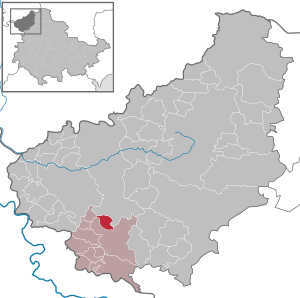
| Location of the municipality of Krombach in the Eichsfeld district | ||
  |
||


Krombach is a municipality in the Eichsfeld district in Thuringia . It belongs to the administrative community Ershausen / Geismar .
location

Krombach is located about nine kilometers south of the district town of Heilbad Heiligenstadt in the Südeichsfeld at the foot of the Obereichsfelder Höhe . The location is framed by the Höheberg (521 m) in the north-west, the Hopfgarten (480 m) in the north-east and the Hühneberg (452 m) in the south-west. The Krombach rises in the village and flows south into the Rosoppe in Ershausen . In terms of traffic, Krombach is connected to the surrounding villages of Bernterode and armaments via the L 2026 state road .
history
Krombach was first mentioned in a document in 1318. It belonged to the villages of the office of Bischofstein, which passed into Kurmainzer possession around 1400 . The first church building in Krombach is mentioned around 1450. The place belonged to Kurmainz until the secularization, from 1802 to 1945 it was part of the Prussian province of Saxony. 1945 to 1949 the place came under the Soviet occupation zone and was part of the GDR from 1949 . From 1961 until the turnaround and reunification in 1989/1990, Krombach was affected by the closure of the nearby inner-German border. Since 1990 the place belongs to Thuringia.
From 1914 to 1947 Krombach was connected to the Heiligenstadt – Schwebda railway with its own train station.
Population development
Development of the population (as of December 31st) :
|
|
|
|
|
- Data source: Thuringian State Office for Statistics
politics
Municipal council
The Krombach local council consists of six council members.
- FFw voter community: 6 seats
(As of: local elections on June 7, 2009)
The 2014 local elections did not result in any change in the distribution of seats.
mayor
- The honorary mayor Guido König was elected on November 12, 2006. On January 6, 2013 the re-election took place with 93.6% of the votes.
Worth seeing
- St. Bartholomew's Church from 1873
- Lourdes grotto
- various hiking trails, including to the Dieteröder cliffs
Individual evidence
- ^ Population of the municipalities from the Thuringian State Office for Statistics ( help on this ).
- ↑ Local elections in Thuringia on June 7th, 2009. Elections for community and city council members. Preliminary results. (PDF; 1.9 MB) The State Returning Officer, accessed on March 7, 2010 .
- ↑ http://wahlen.thueringen.de/datenbank/wahl1/wahl.asp?wahlart=GW&wjahr=2014&habenErg=GEM&wknr=061&gemnr=61062
- ↑ http://eichsfeld.tlz.de/web/eichsfeld/startseite/detail/-/specific/Guido-Koenig-erneut-zu-Krombachs-Buergermeister-gewaehlt-1904390282
Web links
At the Ohmberg | Arenshausen | Asbach-Sickenberg | Berlingerode | Birkenfelde | Bodenrode-Westhausen | Bornhagen | Brehme | Width worbis | Buhla | Burgwalde | Büttstedt | Dieterode | Dietzenrode / Vatterode | Dingelstädt | Ecklingerode | Effelder | Eichstruth | Ferna | Freienhagen | Fretterode | Geisleden | Geismar | Gerbershausen | Gernrode | Glasehausen | Großbartloff | Haynrode | Heilbad Heiligenstadt | Heuthen | Hohengandern | High cross | Kella | Kirchgandern | Kirchworbis | Krombach | Küllstedt | Leinefelde-Worbis | Lenterode | Lindewerra | Lutter | Mackenrode | Marth | Lower Orschel | Pfaffschwende | Reinholterode | Rohrberg | Röhrig | Rustenfelde | Schachtebich | Schimberg | Schönhagen | Schwobfeld | Sickerode | Sunstone | Steinbach | Steinheuterode | Keyings | Services | Thalwend | Uder | Volkerode | Waxed | Wahlhausen | Blowing | Wiesenfeld | Wingerode | Wüstheuterode