Upper Eichsfeld
| Upper Eichsfeld | ||
|---|---|---|
| Highest peak | Höheberg ( 520.6 m above sea level ) | |
| location | Northwest Thuringia ( Germany ). | |
| Part of the main unit | Ringgau – Hainich – Obereichsfeld – Dün – Hainleite , Thuringian Basin (with edge plates) | |
| Classification according to | Handbook of the natural spatial structure of Germany | |
|
|
||
| Coordinates | 51 ° 17 ′ N , 10 ° 16 ′ E | |
| Type | Layered mountain range | |
| rock | Shell limestone (, red sandstone ) | |
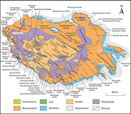
The central part of the western Muschelkalk framing of the Thuringian Basin , main unit Ringgau – Hainich – Obereichsfeld – Dün – Hainleite , is called Upper Eichsfeld , which connects the Hainich in the south with the Dün in the northeast on the Elbe-Weser watershed . It is not congruent with the historical region Obereichsfeld , but lies, in the Thuringian districts of Eichsfeld and Unstrut-Hainich-Kreis (smaller parts in the south), mostly within the same.
Geographical location
In the handbook of the natural division of Germany , Upper Eichsfeld means the entire right of the Werra and northwest and north of the Hainich and southeast of the Dün part of the Muschelkalk main unit Ringgau – Hainich – Obereichsfeld – Dün – Hainleite . In the 6th edition of the manual from 1959, this area is delimited to the south-west by the Eichenberg – Gotha – Saalfeld fault zone . In the single sheet Kassel from 1969, however, shell limestone landscapes beyond the fault zone are also counted as part of the unit, which originally and according to the current classification of the BfN already belong to the lower Werrabergland to the west . Accordingly, one has to distinguish between the Upper Eichsfeld in the narrower and in the broader sense.
The Upper Eichsfeld in the narrower sense extends between the fault zone in the southwest, the Hainich in the south, the Thuringian Basin in the east and the Dün in the northeast. The Lower Eichsfeld connects to the north .
From the northern border of the Hainich along the highway Eigenrieden - Mulhouse runs until Kuellstedt north and then Wachstedt to south Today Hens directed to the northwest, the Elbe-Weser watershed over the plateau. This is replaced to the west via Flinsberg , Kalteneber , Wüstheuterode to the east of Gerbershausen by the watershed between the catchment areas of the Werra and the Leine .
In the north, the area near Heilbad Heiligenstadt meets the Leine valley. In the northeast, between Kreuzebra and Dingelstädt , the Elbe-Weser watershed flows practically into the Dün and its southern roof, from which the Geislede valley to the northwest of Kreuzebra and the Unstrut valley separates to the southeast .
The Upper Eichsfeld in the broader sense also includes landscapes in the Gobert and Wanfrieder Werra Heights near Wanfried as well as their northern slopes in the area of the fault zone, which extend into the Hessian Werra-Meißner district . The Gobert towers above the core ridge by around 50 meters.
The central part of the shell limestone framing is commonly referred to only as "(Eichsfelder) Höhe". In contrast to the neighboring mountain ranges of Dün and Hainich, the landscape is not labeled by name on topographic maps; only the Westerwald as a larger forest area is mentioned in some maps.
Natural structure
The Upper Eichsfeld in the narrower sense is divided natural area in the sporadically wooded Eastern Obereichsfeld on the Elbe-Weser watershed and on the eastern slope of Unstrut and the relief richer and largely forested to Werra (especially Frieda ) and linen abdachende Western Obereichsfeld . The core landscape of the western upper area is also known as the Kalteneberer step edge area.
In the following, the natural areas on the Kassel sheet to the Upper Eichsfeld and south-west of the Eichenberg – Gotha – Saalfelder fault zone , which according to the more common classification are assigned to the Lower Werrabergland , are only listed in small print:
-
(to 483 Ringgau – Hainich – Obereichsfeld – Dün – Hainleite )
-
483.1 Allendorfer Forest
- 483.10 Gobert (up to 569 m)
- 483.11 Weidenbach-Mackenröder depression
- 483.2 Western Upper Area
- 483.20 Kalteneberer step edge area
- Northwestern Upper Eichsfeld on the Werra-Leine watershed (at Höheberg 520.6 m; with Heiligenstädter Stadtwald )
- Westerwald (up to 504 m)
- Southwest slopes between Effelder and Struth (on the Rode up to 498 m)
- 483.21 Upper Friedatal area (at the interface to Hainich up to 472.6 m)
- 483.22 Wanfrieder Werrahöhen (up to 485 m)
- 483.20 Kalteneberer step edge area
- 483.3 Eastern upper field (up to 520.4 m)
-
483.1 Allendorfer Forest
Classification according to TLUG
The Thuringian State Institute for Environment and Geology (TLUG) has a somewhat coarser natural spatial system that only divides it nationwide ( The Natural Areas of Thuringia ), within which the Upper Eichsfeld is divided into two natural areas:
- 3.2 Hainich – Dün – Hainleite mainly comprises the main ridge on the Elbe-Weser watershed up to and including the Heiligenstädter Stadtwald and the Höheberg , as well as the eastern upper area
- 3.3 Werrabergland – Hörselberge includes the remaining parts of the landscape of the western upper area at the stratification level.
mountains
The mountains and elevations include, sorted according to landscape parts and internally according to height:
- Gobert (up to 569 m)
-
Upper calibration field in the narrower sense
- Höheberg (520.6 m), between Krombach and Dieterode
- nameless (520.4 m), northwest of waxedt
- Rain (516.5 m), east of Effelder
- Waiting mountain (515.9 m), north of Flinsberg
- Amt fathom (504.0 m), southwest of waxedt ( Westerwald )
- Eichstruther Kopf (503.0 m), east of Eichstruth
- Madeberg (499.1 m), north of Küllstedt
- Rode (498.2 m), south of Struth
- Ebersberg (494.0 m), south of Kalteneber
- Röhringsberg (486.7 m), south of Thalwend
- Kälberberg (476.6 m), east of Lengenfeld under the stone
- Schimberg (473.4 m, southern summit 457.1 m), southern Westerwald northwest of Großbartloff
- Röhrsberg (468.1 m), northeast of Fretterode
- Uhlenstein (464.7 m), south of Großbartloff
- Lengenberg (461.6 m), west of Lutter
- Schlegelsberg (461.2 m), north of Faulungen
- Ochsenberg (458.3 m), west of Schönhagen
- Bick (453.3 m), north of Martinfeld
- Iberg (Heiligenstadt) (453.0 m), south of Heilbad Heiligenstadt ( Heiligenstädter Stadtwald )
- Hennefeste (446.4 m), west of Birkenfelde
- Dünberg (445.4 m), south of Lengenfeld unterm Stein
- nameless (425.7 m), north of Büttstedt (forest area of the Hollau )
- Kälberberg (374.8 m), southwest of Dörna
-
Wanfrieder Werra Heights
- Keudelskuppe (484.7 m), south of Hildebrandshausen
- Plesse (479.6 m), south-southeast of the Keudelskuppe
- On the Delle (461 m), west of Wendehausen ( Karnberg )
Geology and landscape
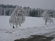
The geological subsoil is mainly formed by shell limestone . To the east, the plateau slopes gently towards the Thuringian Basin . To the north and west it ends with a steep step to the red sandstone . The course of this stage is very structured, as numerous tributaries of the Werra and Leine have cut the landscape here. The steep edges are mostly forested, larger forest areas are in the Westerwald , in the Heiligenstädter Stadtwald and in the Lengenberg near Fürstenhagen . The plateau itself is mainly used for agriculture, although there are unfavorable soil conditions here. Due to the geological structure at the strata, there are numerous natural vantage points:
- Dieteröder cliffs on the Höheberg
- Maienwand and Elisabethhöhe in the Heiligenstadt city forest
- Rotten Schranne
- House windows in the Westerwald
- Hennefeste above Birkenfelde
Waters
The watershed between the Elbe and the Weser runs through the Upper Eichsfeld . To the east, some streams rise towards the Thuringian Basin ( Unstrut , Luhne). Numerous tributaries drain the area to the north to the Leine (Aller) (Geislede, Pferdebach, Lutter, Asbach) and to the west to the Werra ( Frieda , Lutter , Rosoppe).
Economy and Transport
The area of the Upper Eichsfeld is a landscape dominated by agriculture and forestry. Due to the unfavorable soil conditions, the people were dependent on additional gainful employment, so numerous craft businesses developed in the localities. Small companies in the textile and tobacco processing also emerged, of which only a few still exist today. Today there are only major industrial settlements in the area of Dingelstädt and waxedt . Between Küllstedt , Büttstedt and Struth there is a large wind farm with currently 26 turbines.
The Obere Eichsfeld is a bit away from major traffic routes. As the most important road connection, the B 249 between Mühlhausen and Wanfried crosses the ridge in the south at the transition to Hainich and to the east it is touched by the B 247 between Mühlhausen and Dingelstädt. Of the former Leinefelde – Treysa railway lines between Dingelstädt and Lengenfeld unterm Stein , and Heiligenstadt-Schwebda between Heiligenstadt and Krombach , only the former is used as a trolley line for tourists.
Attractions
There are numerous hiking opportunities and sights to visit in the Upper Eichsfeld region:
- Unstrut spring near Kefferhausen
- a center of Germany near Flinsberg
- Pilgrimage place of Klüschen Hagis near waxedt
- Eichsfeld Cathedral in Effelder
- former Anrode monastery near Bickenriede
- former monastery Zella near Struth
- Church ruins in Katharinenberg
- Werdigshaus church near Kefferhausen
- Gleichenstein Castle near waxedt
- Stein Castle and Bischofstein Castle above Lengenfeld unterm Stein
- Nature park center of the Eichsfeld-Hainich-Werratal nature park in Fürstenhagen
- western part of the Mühlhäuser Landgraben between Zella and Eigenrieden
climate
The area of the Upper Eichsfeld lies in the transition area from the subatlantic to the subcontinental climatic area. Climatically, the high altitudes are characterized by an annual temperature that is below 7.0 ° C and annual rainfall of over 800 mm. With a predominantly westerly wind direction, the winters are particularly rich in precipitation.
Individual evidence
- ^ Neureuter, Franz The landscape of the Eichsfeldes . Mecke-Verlag, Duderstadt 1933, page 67
- ↑ H.-J. Klink: Geographical survey: The natural units on sheet 112 Kassel - Federal Institute for Regional Studies, Bad Godesberg 1969 → online map
-
^ Walter Hiekel, Frank Fritzlar, Andreas Nöllert and Werner Westhus: The natural spaces of Thuringia . Ed .: Thuringian State Institute for Environment and Geology (TLUG), Thuringian Ministry for Agriculture, Nature Conservation and Environment . 2004, ISSN 0863-2448 . → Natural area map of Thuringia (TLUG) - PDF; 260 kB → Maps by district (TLUG)
Web links
- BfN landscape profile Ringgau, Obereichsfeld and southern roofing of Dün and Hainleite


