Self-satisfied
|
Self-satisfied
community Rodeberg
Coordinates: 51 ° 12 ′ 35 ″ N , 10 ° 19 ′ 37 ″ E
|
|
|---|---|
| Height : | 476 (445-478) m |
| Incorporation : | June 30, 1994 |
| Postal code : | 99976 |
| Area code : | 036026 |
Eigenrieden is the southeastern part of the municipality Rodeberg in nordwestthüringischen Unstrut-Hainich-Kreis .
location
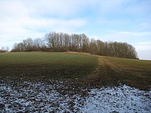
The location is in an altitude range between 445 and 478 m above sea level. NN. However, the district includes parts of the Hainich in the south of the village and extends in the north to the edge of the Dörna forest. This is divided into the agriculturally used north and the predominantly forestry south. The forest area Eigenriedens is the western part of the Mühlhausen city forest , the largest municipal forest in Thuringia. It forms the north-westernmost tip of the Hainich , an extensive, predominantly beech-wooded shell limestone ridge. The 493 m high Hohe Rode is also the second highest point of the Hainich in the Eigenrieder district. The place itself is located in a valley in the former imperial city area of Mühlhausen and northeast of the castle of the Lords of Eigenrieden on the 489.1 m high castle hill, one of the highest elevations of the Hainich. In the west the place borders directly on the Mühlhäuser Landgraben .
history
The place was first mentioned in 1246 as Oygenrieden . The document names a Henricus de Oygeriedin as a witness for the donation of the place to the Order of Teutons based in Mühlhausen. The place name refers to the time of its origin, the high medieval clearing period , during which settlements in previously unpopulated woodland were planned. The name ending -rieden still refers to the act of clearing the forest at that time.
The farms of the place are grouped around a triangular meadow in the south. To the west of the locality, the construction of the Mühlhäuser Landgraben began in the 14th century . It served to protect the former royal estate of the Free Imperial City of Mühlhausen and included Eigenrieden. The Eigenrieder section of the fortification is designed as a double ditch rampart. On the western edge there was the Eigenrieder Warte, a guarded gate passage and a reporting post for Mühlhausen. The basement of the Eigenrieder Warte has been preserved to this day. Today the rampart is a cultural monument and has a natural beech forest.
For centuries self-peace was part of the sphere of influence of the Free and Imperial City of Mühlhausen. In 1565 a population of 54 was counted in self-peace.
On January 1, 1761, during the Seven Years' War , self-peace was occupied by French troops. On February 12, 1761 there was a battle with Prussian troops and Hanoverians to the north and east of the place, in which more than 200 soldiers died.
In 1802 Eigenrieden fell together with Mühlhausen to the Kingdom of Prussia , from 1807 to 1813 to the Kingdom of Westphalia ( Canton Dörna ) created by Napoleon and was assigned to the district of Mühlhausen in the Prussian province of Saxony after the Congress of Vienna in 1816 .
On the northern edge of the village is the village church of St. Ulrich, built in 1725, with the cemetery. More recent development is in the west of the town and north of the B 249, which touches the town in the north. An industrial park has also been built there since the 1990s . In 1980, a 66 m high radar tower for the Red Army was built on the Hohen Rode in the southwest of the Eigenrieden district . In 1995 it was blown up and a Telekom radio tower was built in its place. This is visible from afar and can be seen as a sign of self-peace.
On June 30, 1994 Eigenrieden was incorporated into the new municipality of Rodeberg.
Noble family von Eigenrieden
With Henricus de Oygeridin, a nobleman is named as a witness for the first time in a document. The noble family was presumably used as a ministerial to protect the goods on the castle site of the castle hill. After that they resided in Mühlhausen until 1472, around 1400 a Konrad von Eigenrieden was mayor there.
tourism
Self-satisfied is the starting and ending point of the traditional Rennstieg hiking trail , which leads along the entire Hainichkamm. The hiking trail over the Mühlhäuser Landgraben also begins here .
Others
As evidence of coarse folk humor, neck names and nicknames that characterize each village developed centuries ago . Accordingly, the Eigenrieder Kahlköppe (also Kuhlköppe ) lived here in the village .
literature
- Harald Rockstuhl: Soviet radar station near Eigenrieden in Hainich in Thuringia 1983–1995 . Rockstuhl, Bad Langensalza 2008, ISBN 978-3-937135-79-3 , p. 100 .
Individual evidence
- ↑ Reinhard Jordan (ed.): Chronicle of the city of Mühlhausen in Thuringia. Volume 1: (- 1525). Danner, Mühlhausen 1900, p. 41 .
- ↑ Rolf Luhn: From Oygeriedin after Eigenrieden. 750 years of village history. Luhn, Eigenrieden 1996.
- ↑ Federal Statistical Office (Ed.): Municipalities 1994 and their changes since 01.01.1948 in the new federal states . Metzler-Poeschel, Stuttgart 1995, ISBN 3-8246-0321-7 .
- ^ Community of Rodeberg and office for engineering and traffic construction Goldmann (Mühlhausen): Justification for the land use plan of the community of Rodeberg. 2014, page 19
- ↑ Rolf Aulepp: Nicknames of the places and their residents in the Mühlhausen district. In: Eichsfelder Heimathefte. Vol. 27, No. 1, 1987, ISSN 0232-8518 , pp. 78-83.


